

Services
Hydrography has been one of the technical areas of responsibility of the IH since its creation in 1960. In fact, the importance of hydrography comes from the Time of Discoveries, having evolved over the centuries taking advantage of the advances of science and technology.
Training
Hydrography has been one of the IH’s technical areas of responsibility since its establishment in 1960. In fact, the importance of hydrography dates back to the Age of Discoveries and has evolved over the centuries by drawing on advances in science and technology.
The teaching of hydrography in Portugal, however, predates the creation of the IH, reflecting a long-standing need to understand the sea across various domains of interest. Although the term "hydrography" is often used in a broad sense, it is intrinsically connected to other fields of marine research and activity, such as cartography, oceanography, geology, and navigation.
For many years, future hydrography professionals received academic preparation through various formats and both national and international institutions. However, it was with the establishment of the Training Center in 1970 that the IH gained its own dedicated center of excellence for this purpose. This later evolved into the School of Hydrography and Oceanography, which is now part of the Navy's Professional Training System (SFPM). It remains the only training institution in Portugal offering hydrography courses recognized by the International Board on Standards of Competence for Hydrographic Surveyors and Nautical Cartographers (IBSC), a commission of experts and representatives from the FIG-IHO-ICA (International Federation of Surveyors, International Hydrographic Organization, and International Cartographic Association).
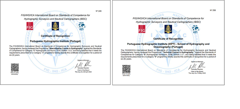
The international recognition granted in the 1980s to the two courses offered marked a qualitative leap, enabling graduates to obtain internationally recognized certification.
The School of Hydrography and Oceanography (EHO)
Established in 1979—initially affiliated with the IH but not part of its formal structure—the EHO is now an integral component of the IH's organizational structure. According to Decree-Law No. 230/2015 of October 12, the EHO is responsible for "conducting courses aimed at training technicians necessary for the hydrographic and oceanographic activities of the IH or, related to these, of interest to the Navy or the Country." The EHO reports to the Director-General of the IH, while also operating under the functional authority of the Navy Personnel Superintendent in matters related to training.
To fulfill its mission, the EHO relies on a team of highly qualified instructors with strong professional and pedagogical backgrounds, primarily composed of military and civilian personnel from various technical departments within the IH. In areas where it lacks internal staff with the required expertise, the EHO also partners with external instructors of recognized merit to teach specific modules within the curriculum.
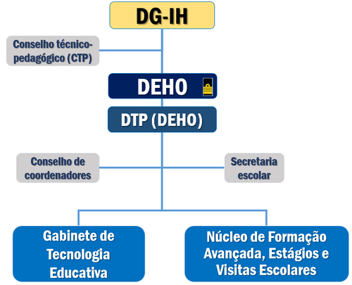
The organizational structure of the EHO is as follows:
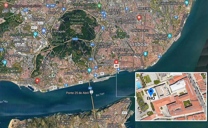
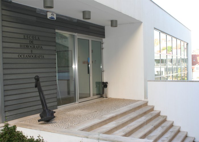
The EHO is located at the IH headquarters on Rua das Trinas in Lisbon.
Results
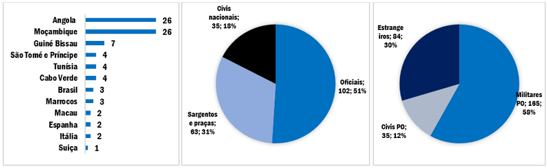
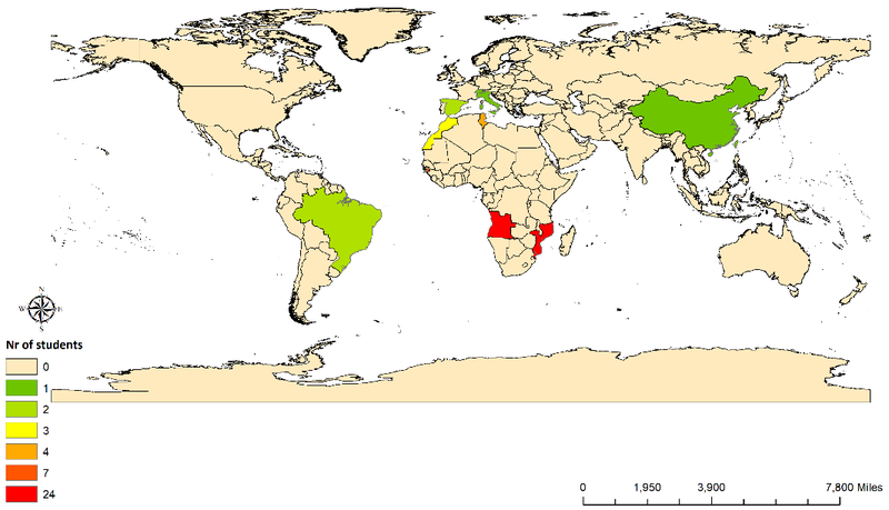
As of September 2024, when the most recent Specialization Course in Hydrography was completed, the EHO had trained a total of 284 hydrographers, as shown in the data below. The figures indicate that students come from a variety of countries and continents, with a predominance of military personnel from Portugal and other Portuguese-speaking countries.
Courses offered at the EHO
The hydrography training offered at the EHO is primarily designed to meet the needs of the IH and the Navy. Any unfilled slots are made available to external applicants, including military personnel from institutions with which the IH has established protocols or cooperation agreements. Additionally, the EHO accepts unsolicited applications from individuals who meet the specified requirements. Each course edition can accommodate up to 12 students.
- Specialization Course in Hydrography, category “A”
- Admission Requirements :
- Bachelor's degree in Science or Engineering (with a background in mathematics and physics).
- Junior officers from the Naval School and students from the Officer Training Course of the Technical Service.
- Academic Components:
- Subjects: Mathematics, statistics, theory of observations, and theory of errors; Numerical Data Processing; Information and Communication Technology; Basic Computer Programming; Physics and electronics; Nautical Science; Nautical Meteorology; Geodesy; Map projections; Positioning using classical methods; Oceanography; Oceanography: applications; Geology and geophysics; Positioning systems in geodesy and hydrography; water levels and flow; Sonar mapping systems; Hydrographic surveys: acquisition; Hydrographic surveys: processing; Management of hydrographic and cartographic data; Cartography: nautical charts; Legal aspects in hydrography and nautical cartography.
- Visits: Navy units and external organizations (1 week).
- Projects: - Complex Multidisciplinary Field Project (10 weeks); Comprehensive Final Cartographic Project (3 weeks)
- Embarkation: on a hydrographic ship (1 week).
- Career Opportunities:
- Hydrographic Institute.
- Universities specializing in marine sciences.
- Port administrations.
- Construction or consulting companies performing hydrographic, geophysical, or oceanographic surveys to support maritime or riverine hydraulic works and the exploration and exploitation of marine resources.
- Fees (registration only):
- Academic year 2025/2026: €9,205.
- Admission Requirements :
- Technical Course in Hydrography, Category "B" (also known Specialization Course in Hydrography for Sergeants)
- Admission Requirements:
- Completion of 12th grade, including mathematics and physics.
- Sergeants in the Navy with a 12th-grade education, including mathematics and physics.
- Academic Components:
- Subjects: Mathematics, statistics, theory of errors; Information and Communication Technology; Basic Computer Programming; Physics and electronics; Nautical Science; Nautical Meteorology; Oceanography; Geology and geophysics; Geodesy and map projections; Positioning using classical methods; Positioning systems in geodesy and hydrography; water levels and flow; Seabed mapping systems; Hydrographic surveys: acquisition; Hydrographic surveys: Nautical cartography; Legal aspects in hydrography and nautical cartography.
- Projects: - Comprehensive Final Field Project (14 weeks).
- Embarkation: on a hydrographic ship (1 week).
- Career Opportunities:
- Hydrographic Institute.
- Universities specializing in marine sciences.
- Port administrations.
- Construction or consulting companies performing hydrographic, geophysical, or oceanographic surveys to support maritime or riverine hydraulic works and the exploration and exploitation of marine resources.
- Fees (registration only):
- Under revision.
- Admission Requirements:
Contacts of the EHO
- General
- E-mail: escolahidrografia@hIdrografico.pt
- Phone contact: +351 210 943 000 (IH General)
- Educational Technology Office: Senior Technician Zélia Cardoso
- E-mail: zelia.cardoso@hidrografico.pt
- Phone contact: +351 210 943 195
- Advanced Training Center and Internships: Senior Technician Maria Melo
- E-mail: maria.melo@hidrografico.pt
- Phone contact: +351 210 943 216
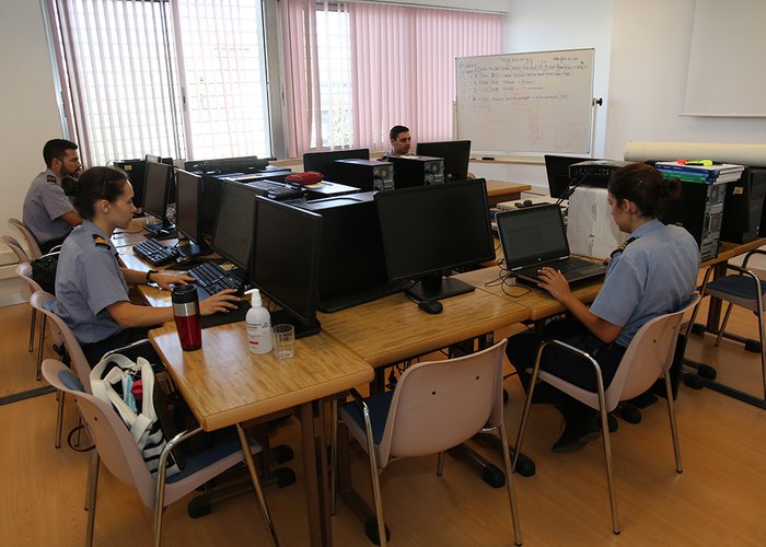
Aula teórica na EHO.
Turma de curso de Categoria A
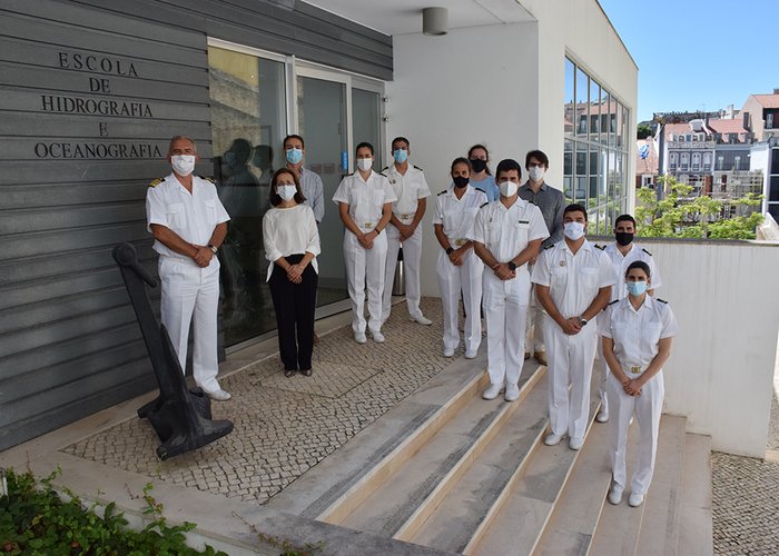
Escola de Hidrografia e Oceanografia
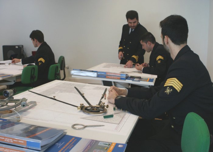
Aula de navegação
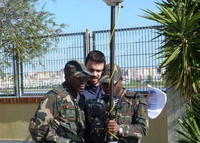
Aula prática - levantamentos geodésicos
55 
2024-05-28