

Services
At the Instituto Hidrográfico, hydrographic surveys are performed mostly by high-resolution multi-beam echo-sounder.
Hydrographic and topographic surveys are performed in accordance with the standards and requirements established in the International Hydrographic Organisation (IHO) standard S-44.
Equipped with state-of-the-art technology in the field of hydrography and topography, the IH operates a wide range of acoustic echo-sounders systems (multi-beam, single beam) adjusted to any depth range.
Prepared for different areas of operation, IH has the naval resources and autonomous vehicles suited to the technical requirements of operating in oceanic, coastal, estuarine and port areas. On land, it uses, for example, drones with LiDAR technology and multispectral cameras, as well as traditional techniques, to survey port structures, cliffs, beaches and/or monitor the intertidal zone.
Topographic and hydrographic surveys are carried out using high-accuracy GNSS positioning with RTK corrections, converted into geo-cartographic reference systems, establishing the connection to the ZH (or NMA) through the application of the respective geoid model and/or tide gauge observations.
Multibeam acoustic systems acquire depth data along a strip transverse to the platform, the width of which depends on the angular aperture of the sounder and the depth. Adequate overlap between surveyed strips allows complete coverage of the entire working area, generating high-resolution images. Analysis of the bathymetric model ensures the selection of minimum depths relevant to navigation safety, as well as the detection of any structures that may constitute a danger to navigation.
Still in the field of hydrography, in depths reachable by light, IH has been a pioneer in the research and development of methodologies that use Artificial Intelligence (AI) to optimise algorithms for deriving bathymetry from multispectral satellite images (SDB).
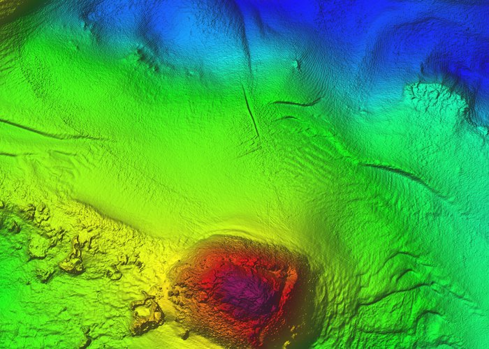
Bathymetry - high resolution image
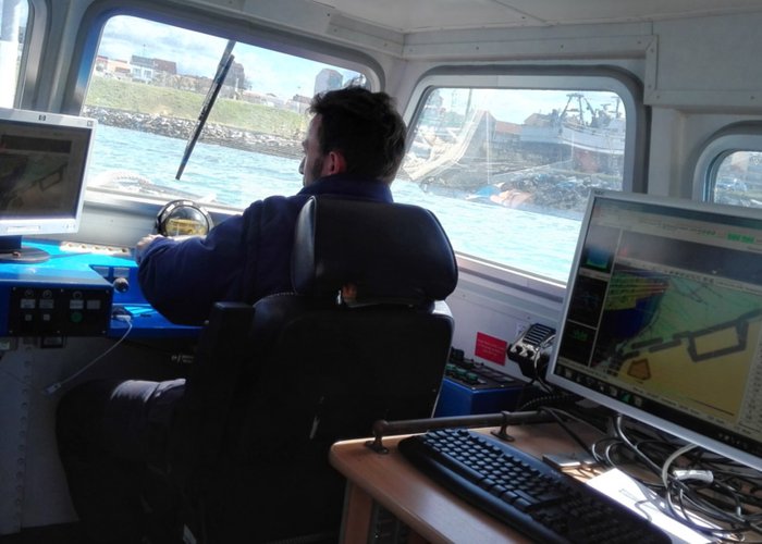
Hydrographic data acquisition
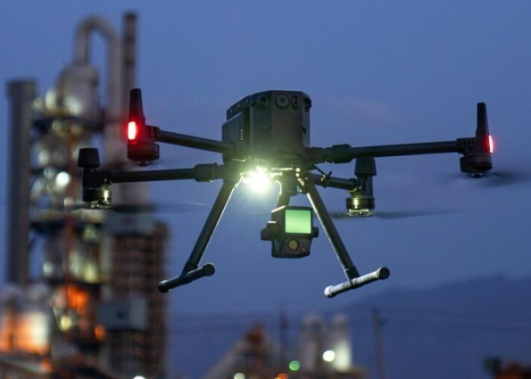
LIDAR technology using the DJI Matrice RTK 300 drone.
125 
2024-05-28