Saltar para o conteúdo principal
Loading/A Carregar
  • Logo do Hidrografico+
  • Logo da Loja do Navegante
  • logo do anavnet
  • logotipo portal arquivo
Português English
Logotipo Instituto Hidrográfico
  • Logotipo Instituto Hidrográfico
  • HI
    • News
    • The Hydrographic Institute
    • The Director-General
    • Institutional Documents
    • Magazines/Publications
    • Quality
    • Recruitment
    • Equality Plan
    • Complaint Channel
  • Products and Services
    • Nautical Cartography
    • Safety of Navigation
    • Oceanographic forecast
    • Services
  • Resources
    • Ships and vessels
    • Unmanned vehicles
    • Laboratories
    • Equipment
  • Activity
    • Programs
    • Projects
    • STANDARD S-100
    • Data Infrastructures
    • IH SensorTech
    • Hydrographic Brigade
    • CGEOMETOC
    • Hydrographic Cartography Regulation
    • Events
  • Data
    • Access to data
    • Data transfer
    • Documentation
  • Infoteca
  • Links
    • NATO MGEOMETOC-COE
    • Public procurement

Techinfo

Installations Special missions 60 Years of the Instituto Hidrográfico

60 Years of the Instituto Hidrográfico

Baia de Santa Marta. N. H.

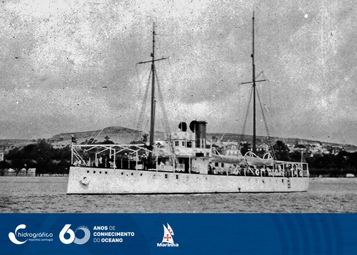
Santa Marta Bay. N. H. ‘Beira’

Separando a Amostra. N.H. «Almirante Lacerda»

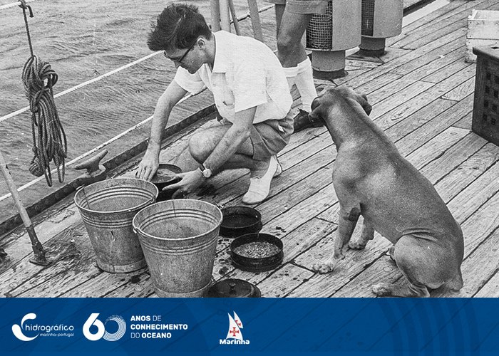
Separating the Sample. N.H. ‘Admiral Lacerda’ (A525) Oceanographic Cruises in 1964

Partida do Navio Hidrográfico «Beira»

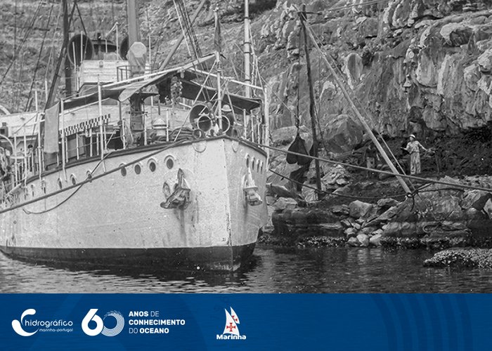
Departure from the ‘Beira’ Hydrographic Ship on 23 September 1936, heading for Angola

Esperando o «Gavião» (vapor de cabotagem da Madeira) na ponta do pesqueiro

Waiting for the ‘Gavião’ (wood cabotage steam) at the end of the fishing boat. N.H. Command report. ‘Carvalho Araújo’ 1937

Quarto e Cozinha-Acampamento de Bafatá.12ª Campanha “Missão Geo Hidro. Guiné”

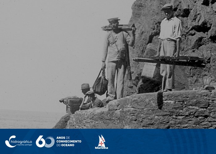
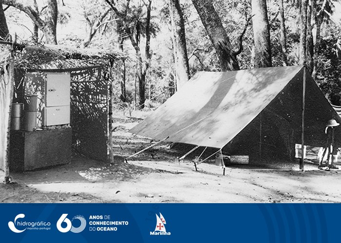
Room and Kitchen - Bafatá Camp. 12th Guinea Geographic Mission Campaign, 9th 1955/56 Hydrographic Campaign

Recolha de amostras de fundo

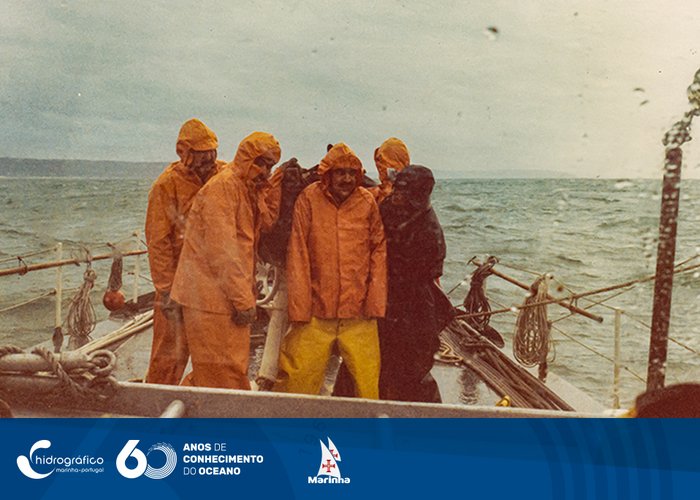
Collection of background samples in the Hydrographic Lanch “Don Jeremiah” A5202. Nazareth, November 1984.

Missão Almeida de Carvalho, Guiné

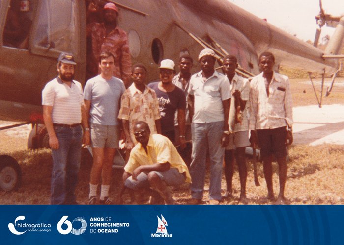
Ponta Ocom, transport for the recognition of the support milestones of the area to be searched at the mouth of the river Cacheu. 1984, Mission Almeida de Carvalho, Guinea.

Levantamento Hidrográfico com «LARC» adaptada a Hidrografia

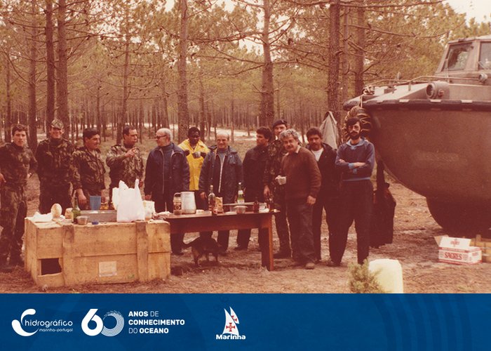
Hydrographic survey with ‘LARC’ adapted to Hydrography. ‘Lunch time’. Early 1984.

OPEN GATE 84

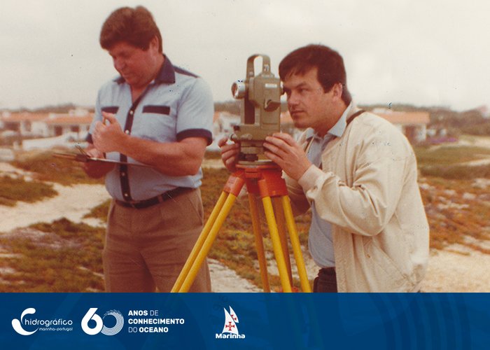
Observation from Porto Covo, with T16. OPEN GATE 84

  • Anterior
  • 1
  • 2
  • 3
  • 4
  • Seguinte

Informations

  • Legal Notice
  • Cookies
  • Accessibility
  • Site Map
  • Site Map

Contacts

Instituto Hidrográfico
Rua das Trinas, nº 49
1249-093 Lisboa
Tel: +351 210 943 000 Access the contact forms
Logo República Portuguesa Logo Marinha Portuguesa Logo do Instituto Hidrográfico
Logotipo com transparências Logo Facebook Linkedin do IH

© Instituto Hidrográfico @ 2025
  • HI
    • News
    • The Hydrographic Institute
    • The Director-General
    • Institutional Documents
    • Magazines/Publications
    • Quality
    • Recruitment
    • Equality Plan
    • Complaint Channel
  • Products and Services
    • Nautical Cartography
    • Safety of Navigation
    • Oceanographic forecast
    • Services
  • Resources
    • Ships and vessels
    • Unmanned vehicles
    • Laboratories
    • Equipment
  • Activity
    • Programs
    • Projects
    • STANDARD S-100
    • Data Infrastructures
    • IH SensorTech
    • Hydrographic Brigade
    • CGEOMETOC
    • Hydrographic Cartography Regulation
    • Events
  • Data
    • Access to data
    • Data transfer
    • Documentation
  • Infoteca
  • Links
    • NATO MGEOMETOC-COE
    • Public procurement
Site Map
  • HI
    • News
    • The Hydrographic Institute
    • The Director-General
    • Institutional Documents
    • Magazines/Publications
    • Quality
    • Recruitment
    • Equality Plan
    • Complaint Channel
  • Products and Services
    • Nautical Cartography
    • Safety of Navigation
    • Oceanographic forecast
    • Services
  • Resources
    • Ships and vessels
    • Unmanned vehicles
    • Laboratories
    • Equipment
  • Activity
    • Programs
    • Projects
    • STANDARD S-100
    • Data Infrastructures
    • IH SensorTech
    • Hydrographic Brigade
    • CGEOMETOC
    • Hydrographic Cartography Regulation
    • Events
  • Data
    • Access to data
    • Data transfer
    • Documentation
  • Infoteca
  • Links
    • NATO MGEOMETOC-COE
    • Public procurement