Saltar para o conteúdo principal
Loading/A Carregar
  • Logo do Hidrografico+
  • Logo da Loja do Navegante
  • logo do anavnet
  • logotipo portal arquivo
Português English
Logotipo Instituto Hidrográfico
  • Logotipo Instituto Hidrográfico
  • HI
    • News
    • The Hydrographic Institute
    • The Director-General
    • Institutional Documents
    • Magazines/Publications
    • Quality
    • Recruitment
    • Equality Plan
    • Complaint Channel
  • Products and Services
    • Nautical Cartography
    • Safety of Navigation
    • Oceanographic forecast
    • Services
  • Resources
    • Ships and vessels
    • Unmanned vehicles
    • Laboratories
    • Equipment
  • Activity
    • Programs
    • Projects
    • STANDARD S-100
    • Data Infrastructures
    • IH SensorTech
    • Hydrographic Brigade
    • CGEOMETOC
    • Hydrographic Cartography Regulation
    • Events
  • Data
    • Access to data
    • Data transfer
    • Documentation
  • Infoteca
  • Links
    • NATO MGEOMETOC-COE
    • Public procurement

Techinfo

Installations Special missions 60 Years of the Instituto Hidrográfico

60 Years of the Instituto Hidrográfico

Missão Geo-Hidrográfica da Guiné MGHG

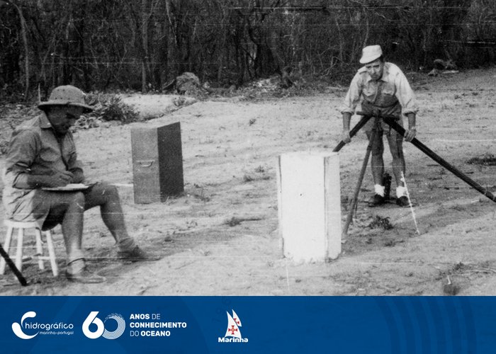
Geo-Hydrographic Mission of Guinea MGHG, April 1954, Piche Base. Due to excessive heat this base has to be measured overnight

Acertos nas pranchetas

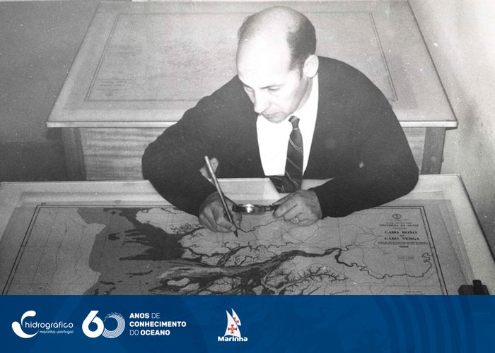
Hits on the clipboards that will give rise to the color plates, for the Offset printing of the nautical charts - 1968

Inauguração do Laboratório do Serviço de Oceanografia

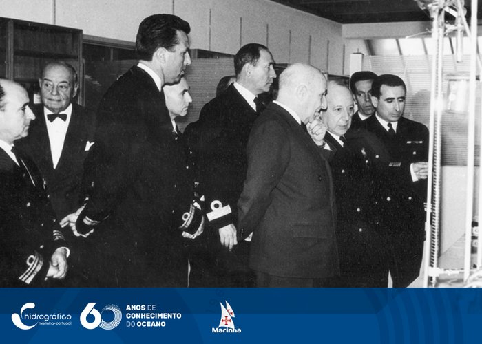
Inauguration of the Oceanography Service Laboratory by Your Honor. the Minister of the Navy, 23 May 1967

Instrução de petromax

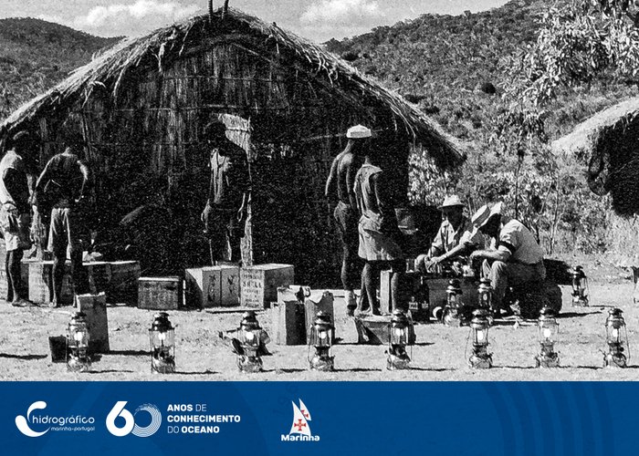
Petromax Instruction, Cobué Camp. Mozambique Hydrographic Mission 1958

Marégrafo

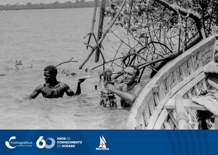
Marégraphe mounted by the Geo-Hydrographic Mission of Guinea (MGHG) on the Cacheu River, 1950

De Metangula para o Cóbuè

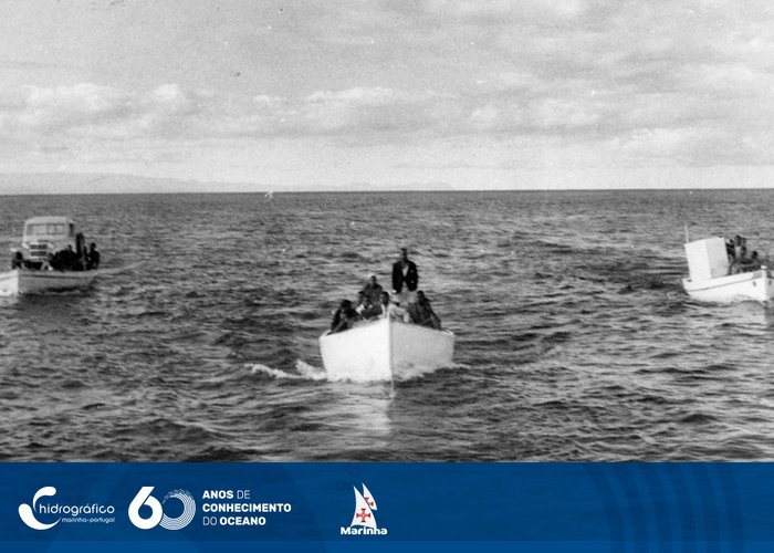
From Metangula to Cobuè (Lago Niassa). Photograph taken from "Mina" - April 1958

Missão Geo-Hidrográfica. Guiné, Rio de Buba

“The tide rises... and observation must be made”. Geo-Hydrographic mission. Guinea, Buba River, April 1955

Garrafa “Bergen Nautik”

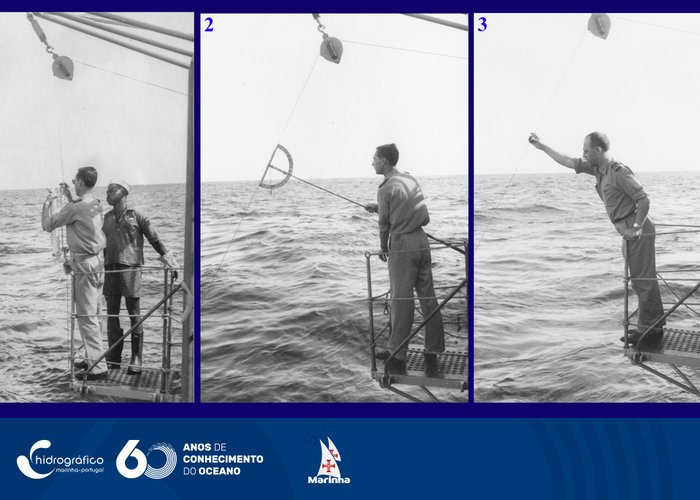
1. Placing a bottle “Bergen Nautik”, 2. Measuring the slope of the wire, 3. Launching the testimony.1964 NH “Admiral Lacerda”

Torre de Caió. «RAYDIST»

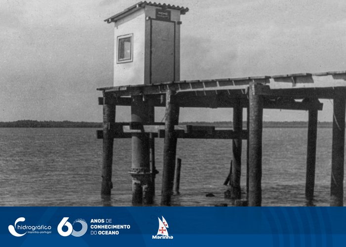
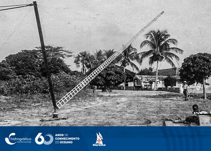
So the Tower of Caió was lifted. ‘RAYDIST’ begins its brilliant career in Guinea. Caió December 1952

  • Anterior
  • 1
  • 2
  • 3
  • 4
  • Seguinte

Informations

  • Legal Notice
  • Cookies
  • Accessibility
  • Site Map
  • Site Map

Contacts

Instituto Hidrográfico
Rua das Trinas, nº 49
1249-093 Lisboa
Tel: +351 210 943 000 Access the contact forms
Logo República Portuguesa Logo Marinha Portuguesa Logo do Instituto Hidrográfico
Logotipo com transparências Logo Facebook Linkedin do IH

© Instituto Hidrográfico @ 2025
  • HI
    • News
    • The Hydrographic Institute
    • The Director-General
    • Institutional Documents
    • Magazines/Publications
    • Quality
    • Recruitment
    • Equality Plan
    • Complaint Channel
  • Products and Services
    • Nautical Cartography
    • Safety of Navigation
    • Oceanographic forecast
    • Services
  • Resources
    • Ships and vessels
    • Unmanned vehicles
    • Laboratories
    • Equipment
  • Activity
    • Programs
    • Projects
    • STANDARD S-100
    • Data Infrastructures
    • IH SensorTech
    • Hydrographic Brigade
    • CGEOMETOC
    • Hydrographic Cartography Regulation
    • Events
  • Data
    • Access to data
    • Data transfer
    • Documentation
  • Infoteca
  • Links
    • NATO MGEOMETOC-COE
    • Public procurement
Site Map
  • HI
    • News
    • The Hydrographic Institute
    • The Director-General
    • Institutional Documents
    • Magazines/Publications
    • Quality
    • Recruitment
    • Equality Plan
    • Complaint Channel
  • Products and Services
    • Nautical Cartography
    • Safety of Navigation
    • Oceanographic forecast
    • Services
  • Resources
    • Ships and vessels
    • Unmanned vehicles
    • Laboratories
    • Equipment
  • Activity
    • Programs
    • Projects
    • STANDARD S-100
    • Data Infrastructures
    • IH SensorTech
    • Hydrographic Brigade
    • CGEOMETOC
    • Hydrographic Cartography Regulation
    • Events
  • Data
    • Access to data
    • Data transfer
    • Documentation
  • Infoteca
  • Links
    • NATO MGEOMETOC-COE
    • Public procurement