

Websig of Electronic Navigation Cards has new interface
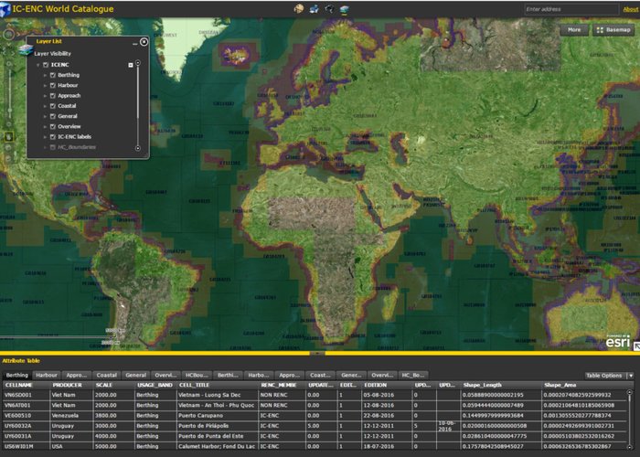
The Hydrographic Institute (HI), through its Information and Communication Systems Division, develops and updates a global-covered WebSIG application that provides the Electronic Navigation Letters (CEN). The basic information comes from the International Centre for Electronic Navigation Charts (ICENC).
The application, updated by the IH, provides Oceanic or Routement (Overview), General (General), Coastal (Coastal), Approach (Approach), Harbour (Harbour) and Berthing, as well as ports and main navigation routes. The previous system worked on the ArcIMS application and has now been upgraded to run in Flex.
WebSIG features features that allow the user to select the visibility of the layers of interest, expand or reduce the area of interest and search by object and attribute. For example, when using the search functionality on a CEN, the user has access to several attributes, namely the chart scale, the producer, the usage band, the title, the editing, the latest update, among other elements.
The application thus allows the user to acquire knowledge about the metadata of the various global CENs produced, as well as the new editions and updates and can be accessed at: http://geosig. hydrographic.pt/flexviewers/ICENC/ .

Websig of Electronic Navigation Cards has new interface
Websig of Electronic Navigation Cards has new interface
138 
2017-02-24