

Topographic Survey at São Torpes Beach
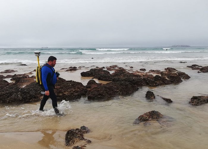
The Hydrographic Brigade held a topographic survey on the beach of São Torpes between December 14 and 16.
The work stems from the request of the Administration of the Ports of Sines and the Algarve (APS), as part of the multiannual monitoring of the effects of the port structures of the port of Sines on the evolution of the adjacent coastal zone, with emphasis on the area of S. Torpes. It has an expected duration of 5 years and involves multidisciplinary work of the Hydrographic Brigade, and the divisions of Hydrography, Marine Geology and Oceanography.
The survey was performed with GNSS receivers Trimble R9, R2 and 5700 in RTK mode (Real Time Kinematic).
Three hydrographers and two equipment technicians participated in this mission, with one of the technicians being trained.
Topographic Survey at São Torpes Beach

Topographic Survey at São Torpes Beach

Topographic Survey at São Torpes Beach

Topographic Survey at São Torpes Beach
108 
2020-12-23