

Topographic and Hydrographic Survey in S. Torpes – 1st Campaign 2021
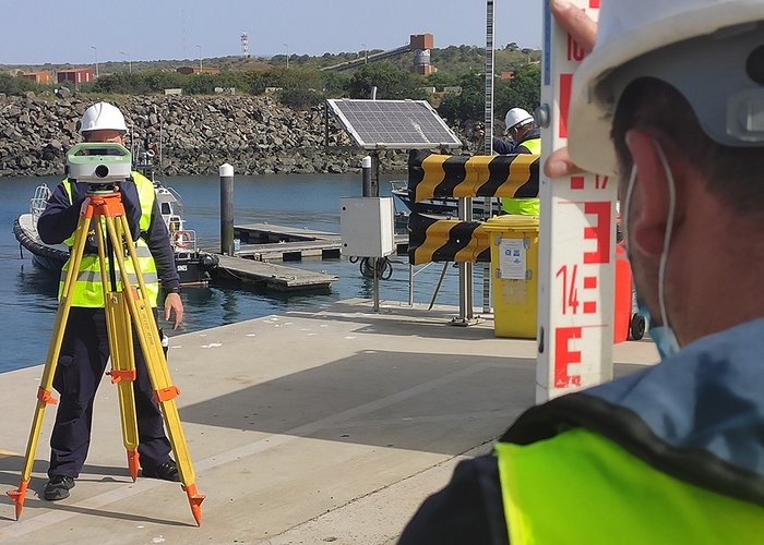
The Hydrographic Brigade (BH) finished the first 2021 campaign of the top-hydrographic survey (LTH) in San Torpes after 5 weeks of work. This mission took place between March 8 and April 9, with the participation of 7 military personnel.
The Hydrographic Institute (HI), at the request of the Administration of the Ports of Sines and the Algarve (APS) S.A, aims to evaluate and monitor quarterly, over five years, the effects of the port structures of the Port of Sines on the evolution of the adjacent coastal morphology, particularly in the area of the beach of São Torpes. The current project involves several divisions of the IH itself, in particular the division of Hydrography, Marine Geology and Oceanography.
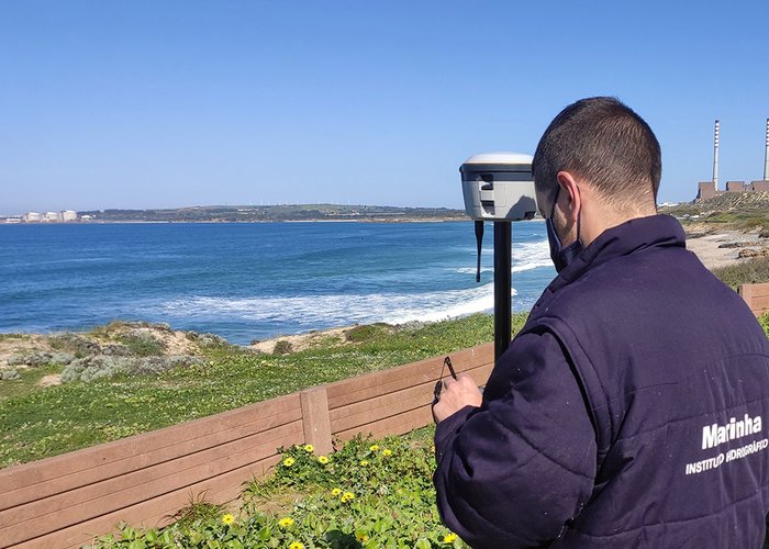
During the five weeks hydrographic surveys were performed using 2 different vessels and multi-beam and single beam probe systems. The beach topography, geometric leveling, and new support points were coordinated using equipment. Global Navigation Satellite System (GNSS) sediment samples were collected for laboratory analysis.
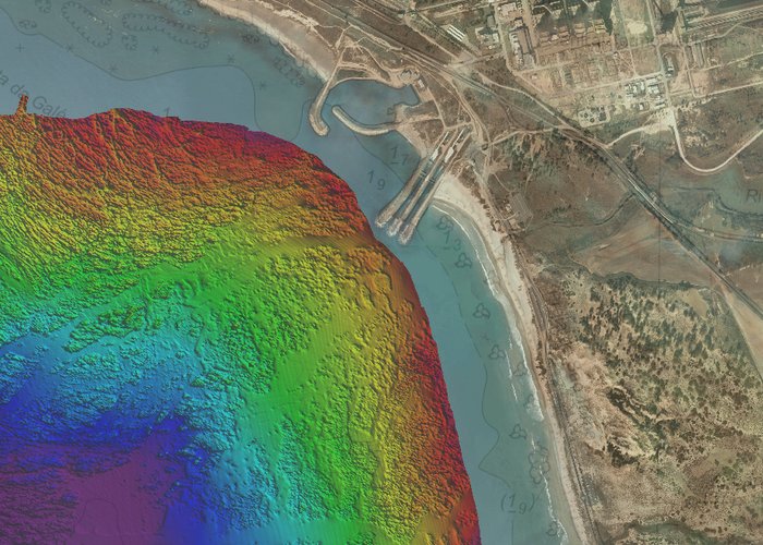
The mission was successfully completed in a different social environment than usual, with an area of 20 km2 being probed and 285 nautical miles of survey and topography traveled.
Top Hydrographic Survey in S. Torpes – 1st Campaign 2021
Top Hydrographic Survey in S. Torpes – 1st Campaign 2021

Top Hydrographic Survey in S. Torpes – 1st Campaign 2021
Top Hydrographic Survey in S. Torpes – 1st Campaign 2021
Top Hydrographic Survey in S. Torpes – 1st Campaign 2021
112 
2021-04-28