

Top Hydrographic Survey of Third Island
Have you ever wondered why the name “Biscuits” is attributed to the region north of Terceira Island, in the Azores archipelago?
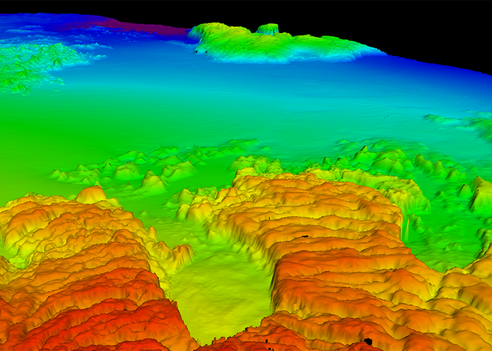
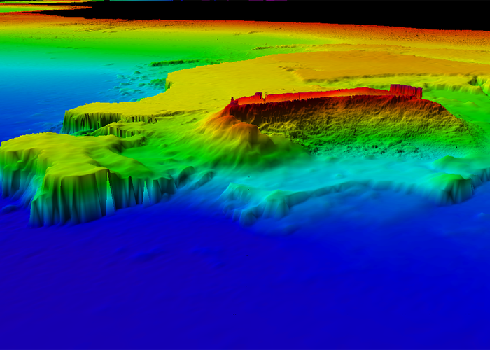
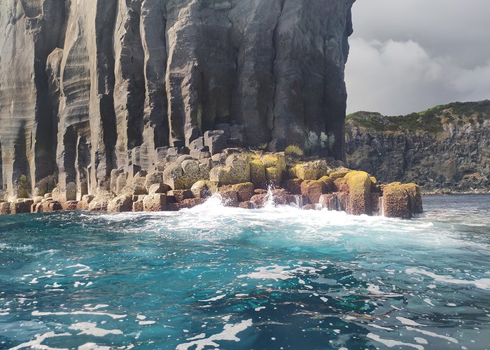
This designation came from the fact that the rocky structures that make up the region's coastline, which are the result of volcanic activity of the past, literally resemble...
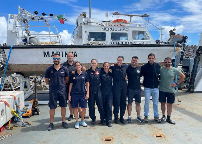
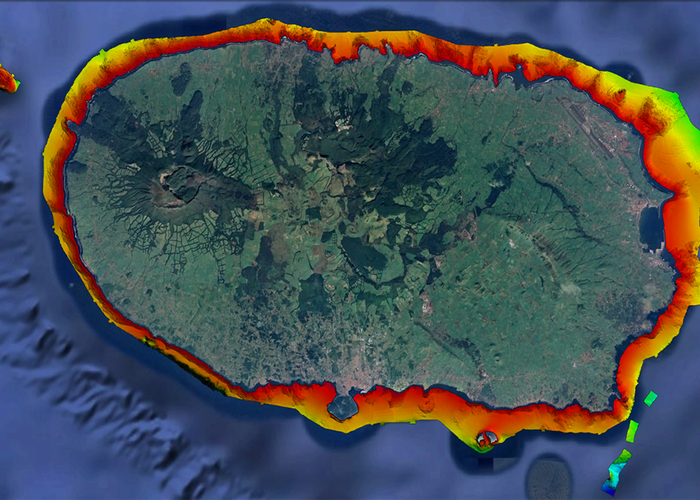
The presence of these volcanic structures (black base) along the third coast was no longer new, but the work carried out by the soldiers of the Hydrographic Brigade and the four students of the Specialization Course in Hydrography and Oceanography, between July 5th and August 12th, taught by the Hydrographic Institute of the Portuguese Navy, enabled the mapping of the “biscoites” present at the bottom of the sea, from the coast line, to its extinction along the continental shelf.
Given that most of the available batimetric information so far came from measurements made more than fifty years ago with plumb wire, the use of a multi-beam probe allowed the complete mapping of the island's coastal edge, with high resolution, leading to the discovery of new underwater structures resulting from seismic and volcanic activity of the region that until now were unknown.
This work allowed not only to increase knowledge of the marine fund of the region from a scientific point of view but also to add relevant information for the safety of navigation in the area, thus contributing to the Portuguese increasingly, and more safely, use the sea, contemplating more closely the natural beauty of our marine areas.
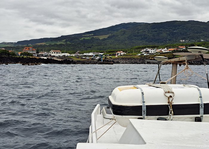
Here are some images (inside and out of water) captured during the work carried out by the Hydrographic Brigade at the bottom of the Azorean Sea.
Top Hydrographic Survey of Third Island
Top Hydrographic Survey of Third Island
Top Hydrographic Survey of Third Island
Top Hydrographic Survey of Third Island
Hydrographic Survey on Third Island
Top Hydrographic Survey of Third Island
119 
2022-09-07