

Top Hydrographic Survey S. Torpes – 3rd 2020 Campaign
From September 14 to October 2, the Hydrographic Brigade conducted the top-hydrographic survey in São Torpes, Sines, which is integrated into the project to monitor the effects of the port structures of the port of Sines.
This project, due to the request of the Administration of the Ports of Sines and Algarve (APS), will take place over 5 years, 2020 being the second year of the project. It is therefore intended to evaluate the effect that the expansion works of the port of Sines (creation of a new container terminal and the extension of the jetty that currently protects Terminal XXI) will have on the oceanographic and sedimentary dynamics of the adjacent coastal areas, particularly in the area of the beach of S. Torpes. Consequently, during the five years several works will be developed by the Hydrographic Brigade and the divisions of Hydrography, Marine Geology and Oceanography.
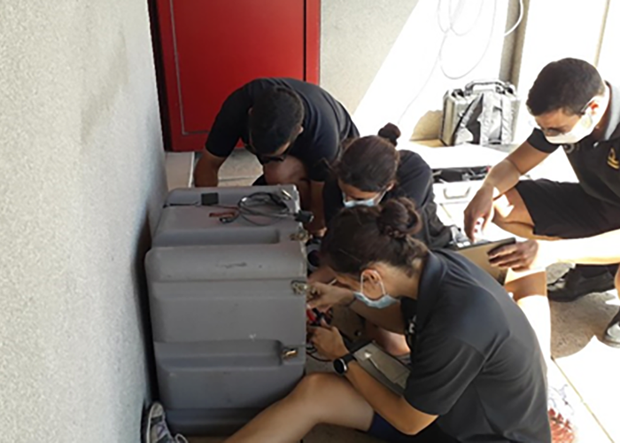
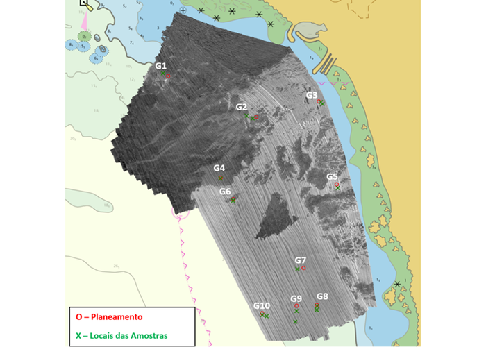
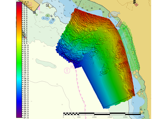
During this campaign, hydrographic surveys were conducted with high-resolution multi-beam probe systems, using the UAM Atlanta (KONGSBERG EM3002) and the Mergulhão waterboat (KONGSBERG EM2040C). A simple beam probe Odom Echotrac CV100 installed on a pneumatic boat was also carried out and the beach topography was performed. At the end of the survey, a bathymetric model with a resolution of 50 cm and a mosaic was created. backscatter which served as support in the selection of sites to perform sediment samples. We selected 10 sites and performed 15 samples using the harvester. Petite Ponar.
The mission was attended by 12 military personnel, four of whom were students of the Specialization Course of Officials in Hydrography, who integrated the mission under the Multidisciplinary Complex Project of this course, which was foreseen as the conclusion of the school curriculum. This project aims to ensure that students perform all practical tasks and exercise the techniques that will be necessary for them in hydrography work, for which they will be responsible in the near future.
During the mission period, two recently acquired campaign tidegraphs were installed, which enabled the quality of the data obtained by the national maregraphic network to be verified, the reliability of these new equipment and for training purposes. Two support points were also maintained and coordinated, in order to be used in future campaigns to verify positioning, both of the GNSS equipments that ensure the positioning of the water speedboats, and the equipment that will be used in the beach topography.
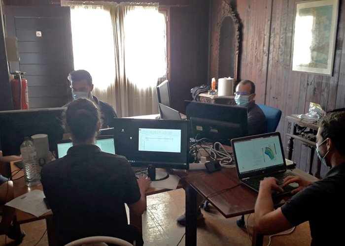
Given the complexity of this mission, dictated by the personnel and material numbers involved, as well as the weather conditions felt, meticulous preparation and rigorous planning were extremely important in order to meet the campaign objectives.
The mission was successfully completed, in a different social context than usual, thus adapting the professionals: military and civilians of the IH, to this “new normal”, in times of COVID-19, continuing the 60 years of existence of the Hydrographic Institute.

Top Hydrographic Survey S. Torpes – 3rd 2020 Campaign
Top Hydrographic Survey S. Torpes – 3rd 2020 Campaign
Top Hydrographic Survey S. Torpes – 3rd 2020 Campaign
Top Hydrographic Survey S. Torpes – 3rd 2020 Campaign
Top Hydrographic Survey S. Torpes – 3rd 2020 Campaign
99 
2020-10-08