

Top-Hydrographic Survey Azores 2021
It would be expected that we would know our seas, as we know other inhospitable places in the world, such as forests, mountain peaks, etc. Currently, according to information from SEAMAP 2030, only 39% of the Azores Sea is mapped.
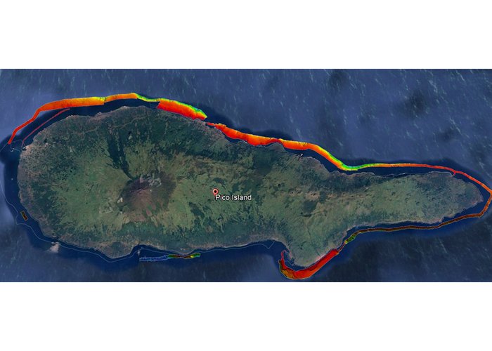
The Hydrographic Brigade in direct cooperation with the Regional Government of the Azores is conducting surveys off Pico Island since the end of July, with the aim of obtaining hydrographic information to support the process of Planning of the Maritime Space of the Azores and for cartographic update.
Over the five weeks planned for the top-hydrographic survey, 3 teams (15 military) and two survey vessels will be placed on the ground, equipped with Kongsberg EM 2040C multi-beam system and Seapath 380 positioning system.
This is an extremely challenging mission from a logistical point of view and knowledge of differences in hydrography and topography.
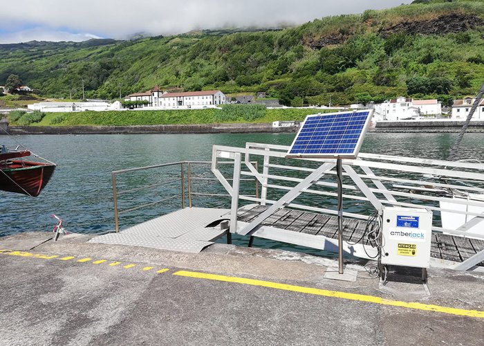
During the last few days, it was possible to establish a maregraphic network on the island, with 3 tidegraphs installed in the three main ports of the island, the realization of two geometric levelings and the permanence and coordination of various support points existing in the work area. More than 32km2 were probed between 0 and 200m deep.
Top-Hydrographic Survey Azores 2021
Top-Hydrographic Survey Azores 2021
Top-Hydrographic Survey Azores 2021
119 
2021-08-13