

Top-hydrographic survey in the central group of the Azores archipelago - 2019
The Hydrographic Brigade began on July 10, 2019 a top-hydrographic survey in the central group of the Azores Archipelago.
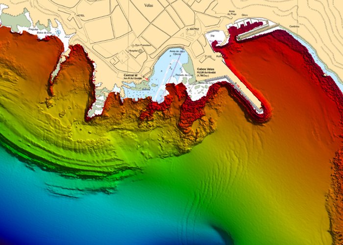
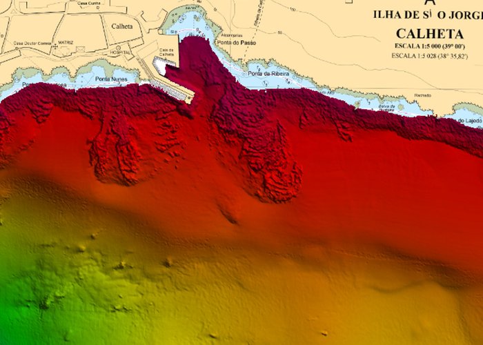
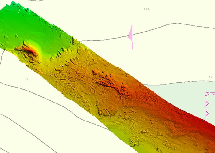
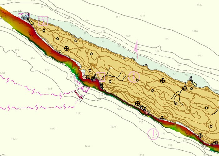
This work arises within the framework of a partnership between the Hydrographic Institute and the Regional Government of the Azores, with the main objective of obtaining updated hydrographic information. The survey focused mainly on the south coast of São Jorge, notably between Ponta dos Rosais and Calheta.
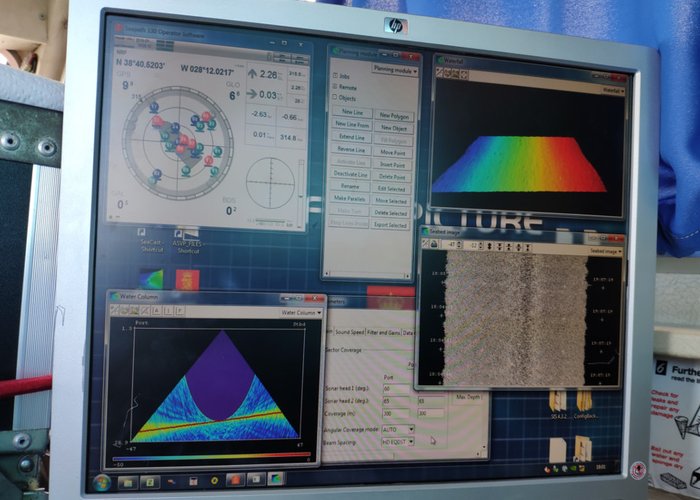
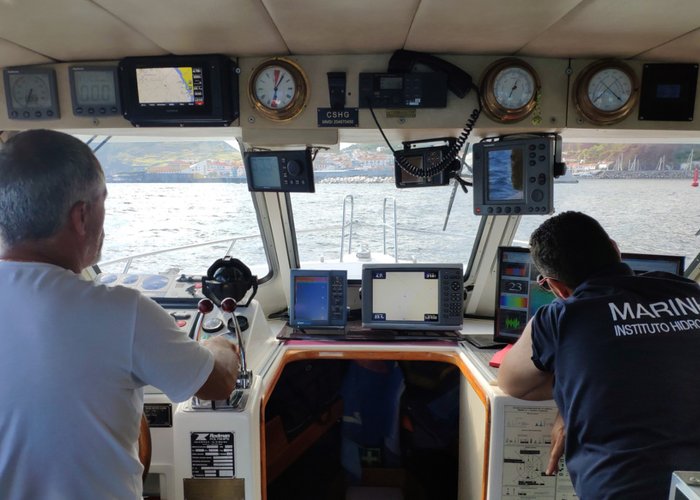
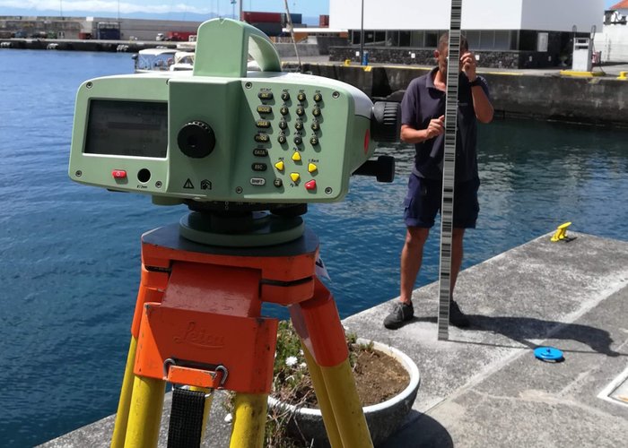
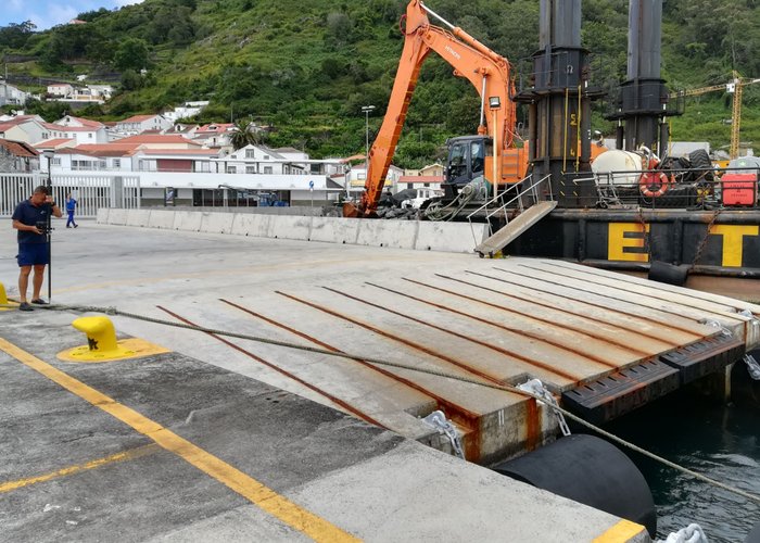
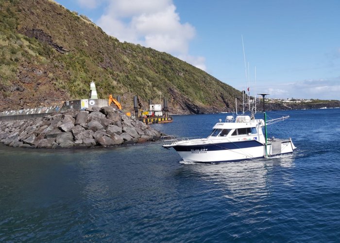
This survey is being carried out on board the “Live Waters” vessel of the Regional Government of the Azores using a high resolution multi-beam probe system. It has a team of 4 people from the Hydrographic Institute and the two elements that constitute the garrison of “Live Waters”.
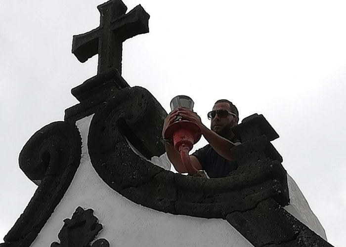
In addition to the acquisition of the bathymetry between the 200 m deep and the coastline, the topographic survey of the main port structures and aids to the navigation of the ports of Velas and Calheta was also carried out. In addition, the topography of some of the Navy's buildings was carried out: the Lighthouse of the Roses, the Sailing Maritime Delegation and the Top Lighthouse.
The mission already has about 130 hours of polling and the end of the data acquisition period scheduled on August 15. The following is a period of processing and conformity assessment of the work carried out in order to ensure the quality of the acquired river information.
Top-hydrographic survey in the central group of the Azores archipelago - 2019
Top-hydrographic survey in the central group of the Azores archipelago - 2019

Top-hydrographic survey in the central group of the Azores archipelago - 2019

Top-hydrographic survey in the central group of the Azores archipelago - 2019
Top-hydrographic survey in the central group of the Azores archipelago - 2019
Top-hydrographic survey in the central group of the Azores archipelago - 2019
Top-hydrographic survey in the central group of the Azores archipelago - 2019
Top-hydrographic survey in the central group of the Azores archipelago - 2019
Top-hydrographic survey in the central group of the Azores archipelago - 2019
Top-hydrographic survey in the central group of the Azores archipelago - 2019
Top-hydrographic survey in the central group of the Azores archipelago - 2019
Top-hydrographic survey in the central group of the Azores archipelago - 2019
120 
2019-08-10