

Top-hydrographic survey in the central group of the Azores archipelago - 2020
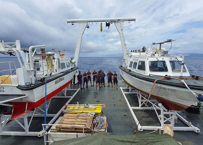
The Hydrographic Brigade finalized on September 2 the top-hydrographic campaign held on the island of Pico, with 5 weeks of survey conducted by 3 teams.
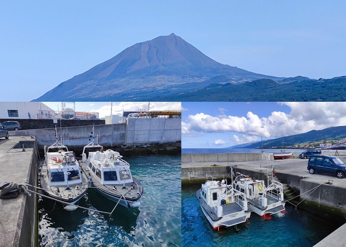
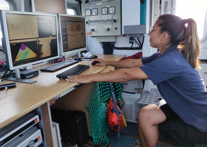
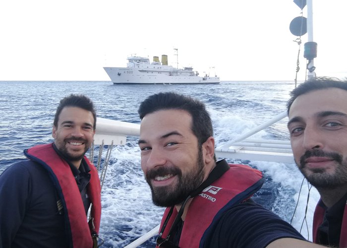
The survey was carried out with the Mergulhão waterboat and reinforced in the last week and a half, by the waterboat Seagull, transported to the survey area by the hydrographic ship NRP D. Carlos I.
Waterboats equip the most modern multi-beam systems (KONGSBERG EM2040C) and positioning/attitude (SEAPAH 380) today.
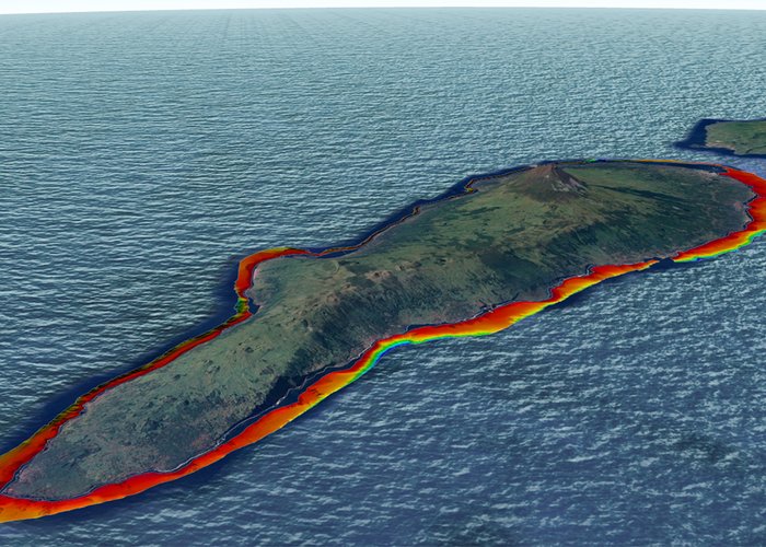
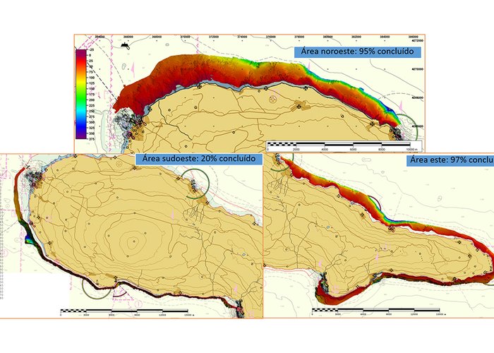
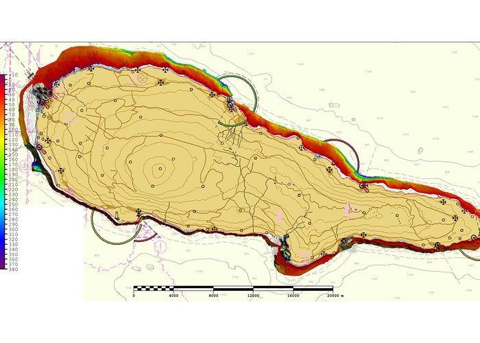
Pico Island is the second largest island in the Azores and its survey was enhanced by the following factors:
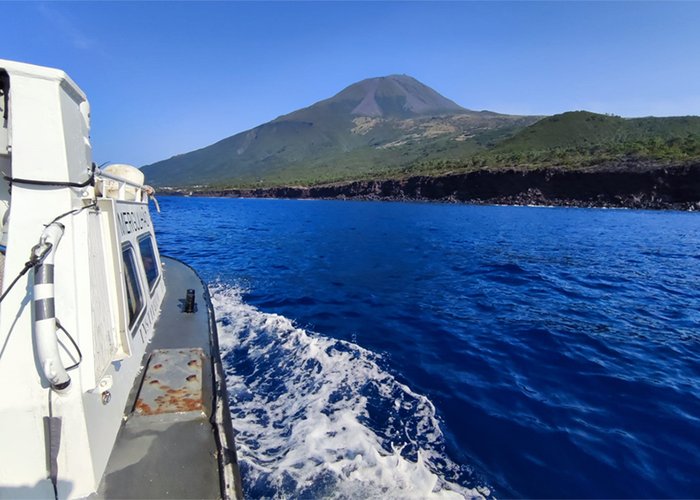
- Predominance of good weather and oceanographic conditions (METOC);
- Vantajoso geographical positioning of the shelter ports of the island of Pico, mainly the ports of Madalena, Lajes and S. Roque. Its distribution made it possible to conduct surveys between ports, increasing the efficiency of the polling effort, reinforcing security and allowing the use of the relocation of means to sheltered areas on days of conditions. METOC unfavorable.
The survey work took place between 10 and 350 meters deep and, although it was carried out between 7 and 8 hours of daily survey per vessel, it was not possible to finalize the hydrographic survey. This was due to the short time available for the mission and the fact that the platform adjacent to Magdalena consists of an extensive low-deep area with complex oceanography.
The data acquired were of great quality. The main causes, largely due to the rigor of the positioning and attitude of our speedboats, with differential corrections in mode Real Time Kinematic (RTK) aggregated to the stations of the Permanent Station Network Autonomous Region of the Azores (REPRAA). For vertical reference, we counted on a robust tidal network, two belonging to the Oceanography Division of the Hydrographic Institute (Horta and Terceira) and three installed at the beginning of the mission in the main ports of the island of Pico. This tidal network was constantly motorized and allowed, due to redundancy, to identify misadjusted geometric installation/leveling problems.
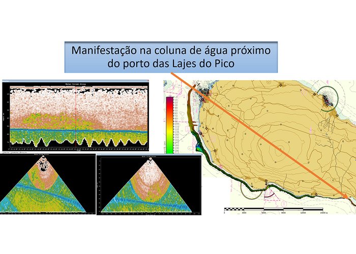
During the hydrographic survey, there were acoustic manifestations in the water column in 3 places on the island of Pico. These manifestations were observed persistently on different days. After observing these disorders, data from the water column were recorded and processed, and their location for future studies was identified. The demonstration located near the port of Lajes is highlighted, being at a depth of 50 meters, which may facilitate its study.
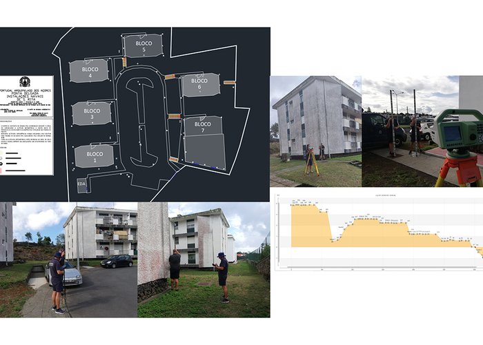
At the end of the campaign a small team of 3 elements carried out the topographical survey and geometric leveling of Santa Rita naval facilities in Ponta Delgada.
After the campaign, the boats boarded the NRP hydrographic ship D. Carlos I, with most of the team, to make transit to Lisbon Naval Base.
Thank you for the hospitality and logistical facilities given by the Captaincy of Porto da Horta, the Volunteer Firefighters of Madalena and the general population for the excellent welcome. This was a productive, complex and exciting mission, carried out on the exuberant island of Pico, where the work consisted of searching the way the roots of the island, which hold the highest location in Portugal, submerged.
Top-hydrographic survey in the central group of the Azores archipelago - 2020
Top-hydrographic survey in the central group of the Azores archipelago - 2020
Top-hydrographic survey in the central group of the Azores archipelago - 2020
Top-hydrographic survey in the central group of the Azores archipelago - 2020
Top-hydrographic survey in the central group of the Azores archipelago - 2020
Top-hydrographic survey in the central group of the Azores archipelago - 2020
Top-hydrographic survey in the central group of the Azores archipelago - 2020
Top-hydrographic survey in the central group of the Azores archipelago - 2020
Top-hydrographic survey in the central group of the Azores archipelago - 2020
Top-hydrographic survey in the central group of the Azores archipelago - 2020
134 
2021-09-10