

Hydrographic survey via the Douro – Estuary of the river Douro – End of the Campaign
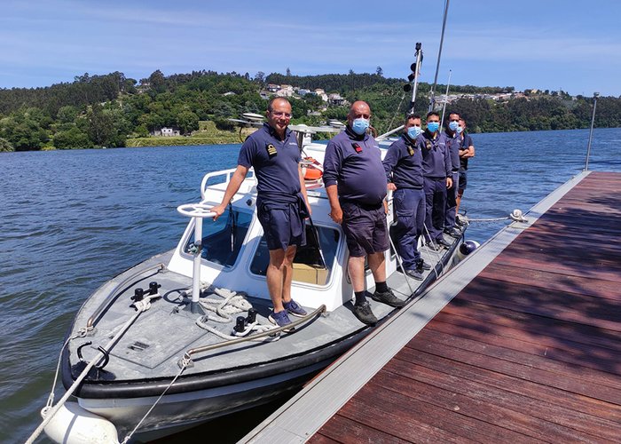
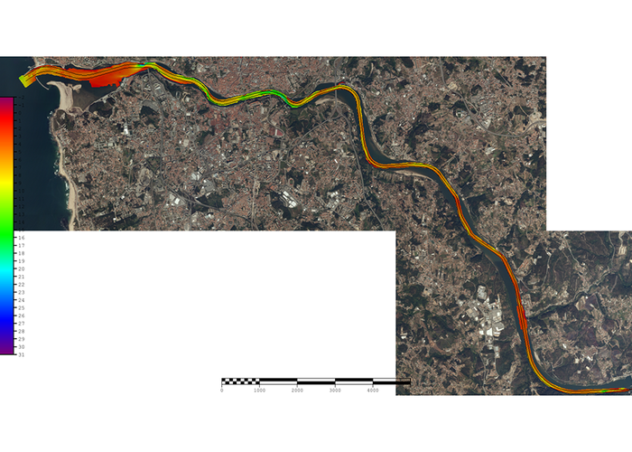
The Hydrographic Brigade (BH) finished the Hydrographic Survey (LH) of the Douro waterway (VND) from the mouth of the Douro to the Crestuma dam, on May 26, 2021, making 3 weeks of survey and 3 days to coordinate buoys and beacons and densification of probing.
This work had over a hundred hours of navigation and an extension of 22 km. On average, the water boat ran 8 hours a day, with the team surrendering at lunchtime.
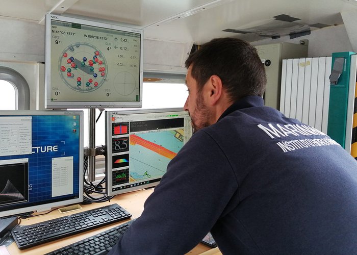
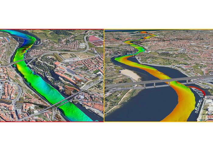
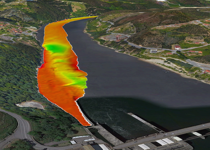
The greatest difficulty experienced during the hydrographic survey was the area of the mouth of the river Douro where the variation in the propagation of sound in water was very variable which required the realization of a large number of vertical profiles of sound speed. As we moved up the river, this issue was decreasing. In 15 days of surveying, 67 sound velocity profiles were performed in the water. This parameter, constantly updated, promotes a good quality of the batometric data, since it reduces the refractive errors in the tracing of sound rays.
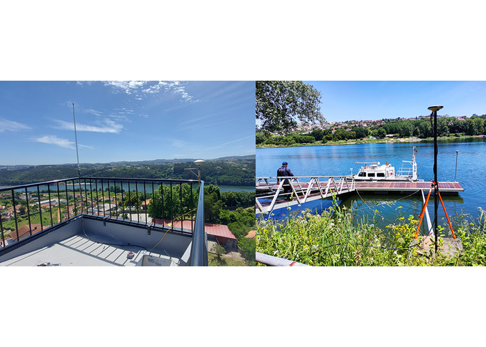
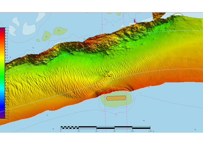
Another difficulty was the survey under the various bridges that cross the river, where the loss of integrity GNSS and consequently the rigor in the positioning, especially in the vertical. In these locations, we used the data of the installed tidegraphs, which allowed us to obtain an excellent quality of the batimetric model proven by the possibility of viewing small ripples created by the current under the bridges.
Overall, the quality of the data obtained was excellent, with vertical uncertainties less than 20 cm.
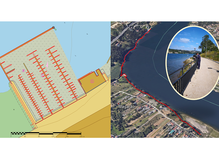
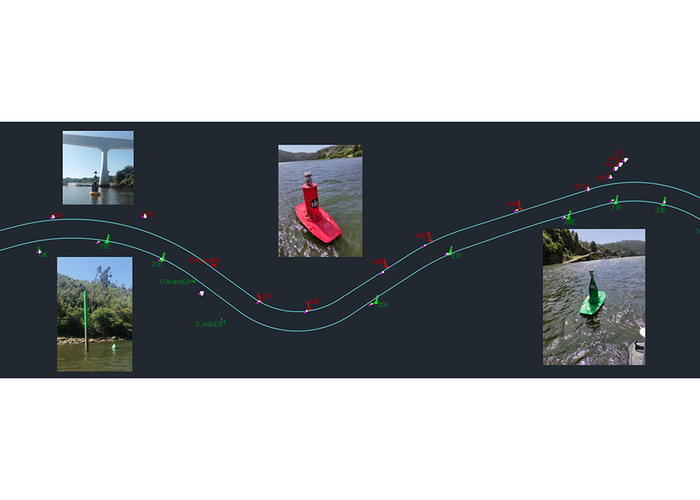
We also coordinated 105 buoys and beacons that delimit the navigation channel and then, in processing, we verified the design position in relation to the position obtained.
A new topography was also carried out at the Douro marina, Freixo and Avintes, on the Douro bridge.
Quality control was performed daily as well as the analysis of discrepancies between the new bathymetry and the nautical chart. In this sense, 4 hydrographic reports were made for possible publication of warnings to the navigators.
At the end of this campaign, the hydrographer of the survey was exchanged so that the survey could process the data obtained. A new team will be responsible for the survey in the next two reservoirs of the Douro River.
The data acquired will be made available for updating the batimetric information and analysis of any need for dredging, signalling or updating nautical publication such as nautical charts or electronic navigational letters.
Hydrographic survey via the Douro
Hydrographic survey via the Douro
Hydrographic survey via the Douro
Hydrographic survey via the Douro
Hydrographic survey via the Douro
Hydrographic survey via the Douro
Hydrographic survey via the Douro
Hydrographic survey via the Douro
Hydrographic survey via the Douro
Hydrographic survey via the Douro
152 
2021-06-01