

Helena Storm
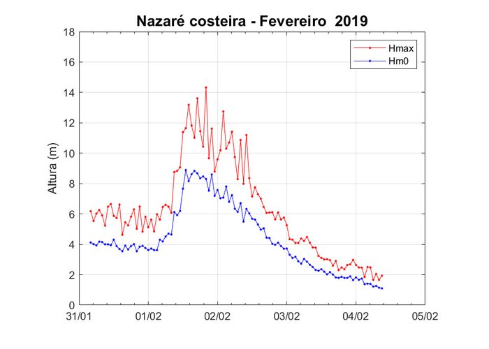
During February 1 and 2 there was a worsening of the state of the sea in mainland Portugal due to the passage of storm Helena. This storm, originated by the propagation of a low pressure in the North Atlantic, generated a strong West ripple.
The observation network of the Hydrographic Institute recorded in its buoys the passage of storm Helena. On February 1st, there was a significant height of 9.6m (at 20:00) and a maximum height of 16.4m (at 17:00). A significant height of 8.9m and 14.3m was observed in the Coastal Nazaré buoy. The storm was also felt in the Sines coastal buoy which recorded a significant height of 7.2m (20:00) and maximum height of 11.1m (22:30).
Additional information on the satellite image shown:
Corrected Reflectance (True Color; MODIS; Near Real Time), with overlap of the wind speed field (m/s) over the ocean (Descending, DMSP-F16, SSMIS) for 1FEV2019. (Source: NASA Worldview).
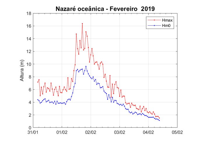
Records of the ‘Nazaré Oceânica’ buoy
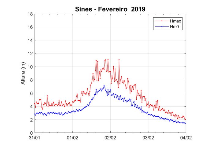
Sines buoy records
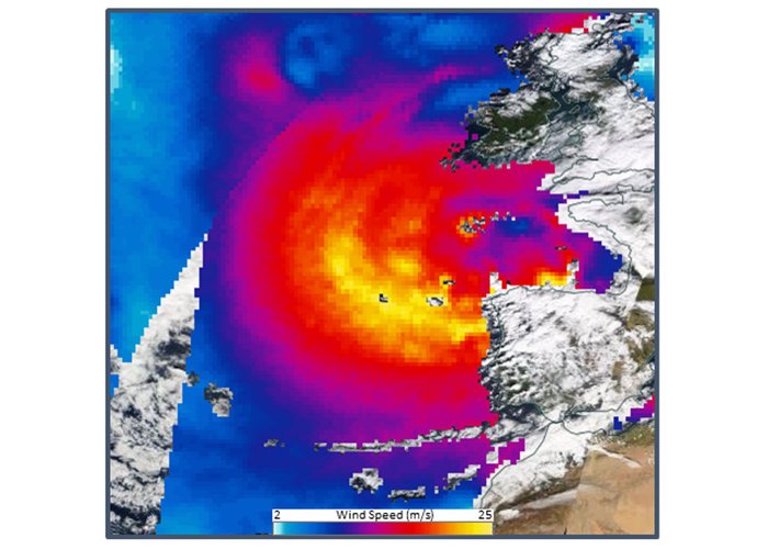
Satellite image (source: NASA Worldview)

Helena Storm
Helena Storm
112 
2019-02-04