

New Version of SEAMAP2030 Bathymetric Data Now Available
The SEAMAP2030 project continues to advance with the goal of fully mapping the maritime spaces under national jurisdiction by 2030.
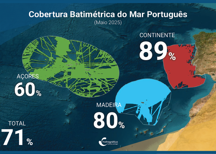
A new version of the bathymetric data is now available, featuring greater spatial coverage, over 63 million depth measurements, and five horizontal resolutions based on depth ranges:
50–250 m → 32 m resolution
250–1,000 m → 64 m resolution
1 000–2 000 m → 128 m resolution
2 000–4 000 m → 256 m resolution
> 4 000 m → 512 m resolution
The data can be downloaded here: https://doi. org/10.71683/ebacc5a6-0504-4f97-94e5-4e5146dd0318
Learn how to download the data here:https://www.facebook.com/share/r/179sswHc1d/?mibextid=wwXIfr
The new version of the baptismal data of the SEAMAP2030 project is already available
109 
2025-09-10