

Guadiana Project Natural Heritage Navigable at good pace
A meeting of the partners of the GUAD 20 project (“Guadiana: Navigable Natural Heritage”) took place in Ayamonte on April 30. This project is funded by the Portugal-Spain Transboundary Cooperation Operational Programme (POTEP INTERREG V-A 2014-2020), and as partners, the Public Agency of Puertos de Andalucia (Promoting Entity) and the Directorate-General for Natural Resources, Security and Maritime Services (DGRM).
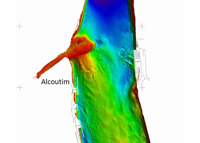
The GUAD 20 aims to rehabilitate the navigability of the Guadiana river in the international section between Vila Real de S.to António and Pomarão, in security conditions, as well as rehabilitating existing port infrastructures on both banks. Under this project the Hydrographic Institute (IH) is the entity responsible for the production of the official hydrographic cartography of the Guadiana Navigable Way between Vila Real de S.to António and Pomarão.
The meeting aimed to present to the various regional entities the project's status, as well as to highlight the next actions of the partners.
The IH highlights the completion of the processing of hydrographic data acquired in the 2017 and 2018 campaigns. Next, the IH will start modeling data for the construction of nautical cartography, with its completion expected in 2020.

Guadiana Project Natural Heritage Navigable at good pace
Guadiana Project Natural Heritage Navigable at good pace
Guadiana Project Natural Heritage Navigable at good pace
102 
2019-04-30