

Cape Verde Sea Institute provides data on the relief of the seabed
The I.P. Sea Institute (IMAR) provides data on the subsea relief of the Cape Verde Exclusive Economic Zone, collected on several national and international scientific cruises. The initiative developed in close collaboration with the Portuguese Navy Hydrographic Institute (IH), a body primarily responsible for maintaining nautical mapping of the area, aims to support the international project SEABED 2030 and, consequently, the goals of the United Nations decade of Ocean Science for sustainable development.
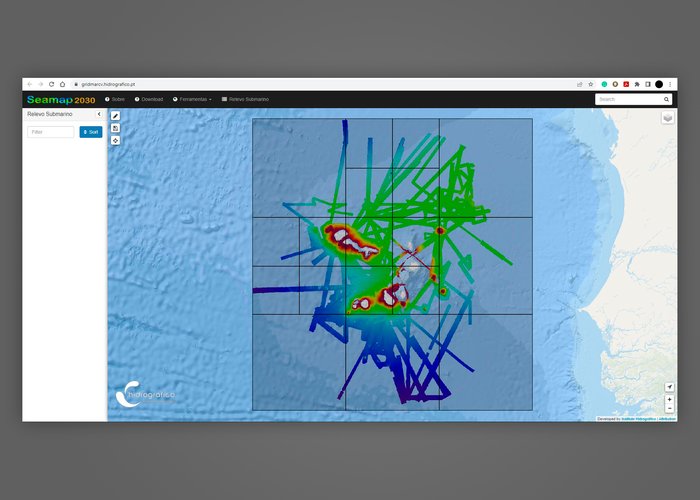
The GridmarCV geographic information system provides scales of baptismal data, with resolutions that vary according to depth, which contribute to the conservation and sustainable use of the sea, supporting research and promoting development.
An initiative that will certainly have a significant impact on increasing global knowledge of the ocean and the morphology of the seabed.
Resolutions made available:
- Prof. 50m-250m – Res. 32m
- Prof. 250m-1000m – Res. 64m
- Prof. 1000m-2000m – Res. 128m
- Prof. 2000m-4000m – Res. 256m
- Prof. +4000m – Res. 512m
The data may be accessed through the following address:https://gridmarcv.hydrographic. en.
Cape Verde Sea Institute provides data on the relief of the seabed
139 
2023-05-02