

Hydrographic Mission Azores 2019
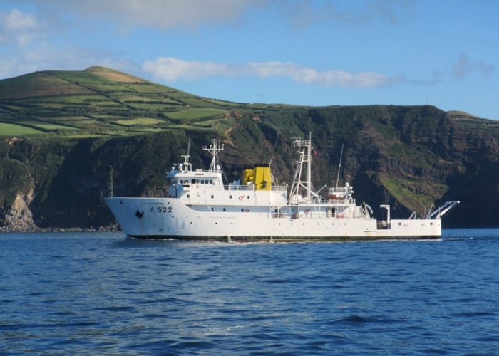
The Hydrographic Institute (IH), through the Portuguese Navy ship NRP D. Carlos I and the Hydrographic Brigade (BH), in collaboration with the Regional Government of the Azores (GRA) and the Mission Structure for the Extension of the Continental Platform (EMEPC), is conducting a hydrographic survey in the Azores.
The 2019 Azores Hydrographic Mission was designed by the IH, in accordance with the assignments and objectives of the Portuguese Navy with regard to scientific research, in particular, regarding the Portuguese Sea Mapping program (http://www.hydrografico.pt/iproject/16), and in the context of existing institutional cooperation with the GR and the EMECC.
The NRP D. Carlos I will be engaged in two activities:
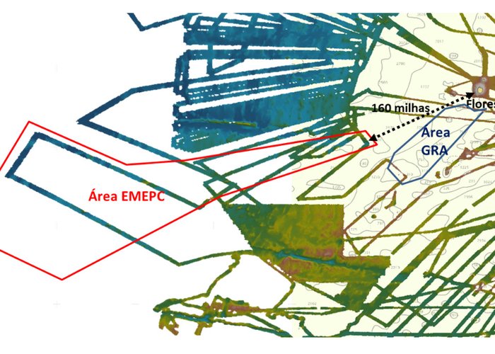
- Hydrographic surveys in cooperation with the EMECC: Collaboration to map in detail areas of common interest.
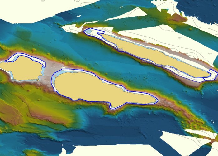
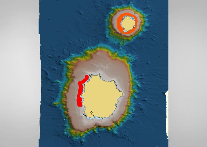
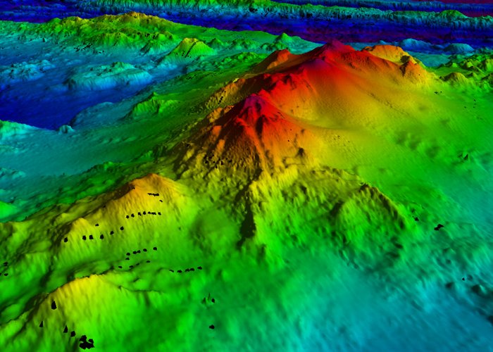
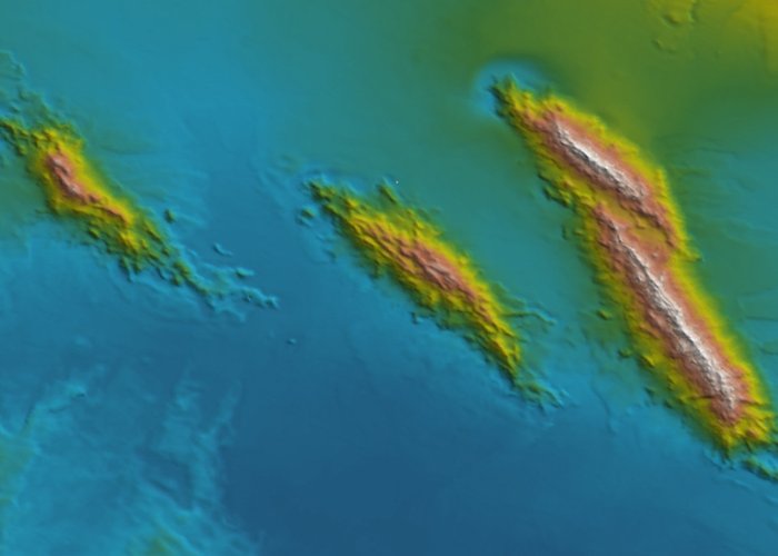
- Hydrographic surveys in cooperation with the GRA: to be carried out on several underwater hills located between Flores Island and the area of interest for the EMSPC.
The underwater hills are topographical structures that rise from the bottom of the submarine and have the peak below the surface of the sea. There are numerous underwater mountains in Portuguese waters, many of them not yet documented. The relevance of their study is that they are considered differentiated sites, in their form, composition and existence of specific oceanographic phenomena and also in terms of biodiversity and potential resources, which must be identified and quantified in order to improve their protection and sustainable management through appropriate regulation. The determination of the relief of those mountains with high detail is the fundamental basis that will support any study of another nature or regulation that will be carried out.
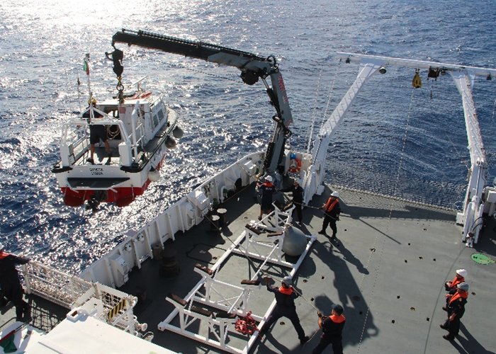
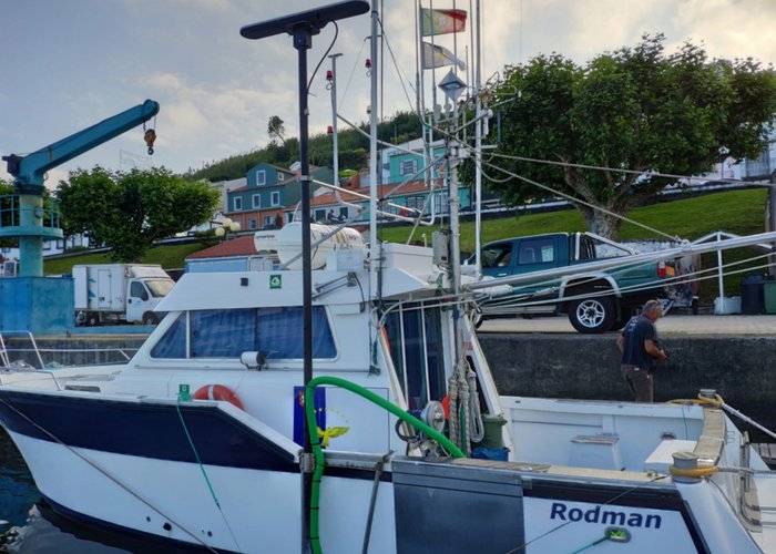
In parallel with the work of the ship, two teams of BH were deployed. One will be landed in the Western Group together with one IH survey vessel, while the other is already active in the Central Group on the GRA vessel Live Waters. The work of the BH has as fundamental objectives the collection of high resolution batimetric information, with identification of rocky structures and sedimentary zones, in the areas of the maritime space adjacent to the Azores Archipelago, with the purpose of filling knowledge gaps, that is, in areas where there is currently a lack of data and/or the existing information is of low resolution, to support the process of Planning the Maritime Area of the Azores and to contribute to the safety of navigation. The following work is planned:
- Western Group: continuation of the work carried out in 2018, focusing on the Port of the House (Corvo) and the coastal strips between the coastline and the 50 m deep of the Corvo Island and the northwest area on Flores Island.
- Central Group: hydrographic surveys of the ports of S. Jorge and the coastal ranges between the coastline and the 50 m deep, of the islands of S. Jorge, Pico and Faial (north).
Finally, the IH will also collaborate with the GRA at the level of satellite image processing and, if possible, photographs obtained by aerial means, in order to derive baptometry in the areas near the coast where, for the safety of the teams, it is not possible to acquire data through acoustic methods, usually used in Hydrography.
The NRP D. Carlos I left the Lisbon Naval Base on 12 July, making its first stop on 18 July on Faial Island, and will return to Lisbon at the end of August.
The Portuguese Sea Mapping program is an inclusive program that promotes and encourages the opportunity for collaboration and participation of Portuguese entities, which carry out activities for the benefit of the marine sciences. The 2019 Azores Hydrographic Mission once again realizes the relevance given by the participating entities to the effective research work carried out in the Portuguese Sea.
Hydrographic Mission Azores 2019
Hydrographic Mission Azores 2019
Hydrographic Mission Azores 2019
Hydrographic Mission Azores 2019
Hydrographic Mission Azores 2019
Hydrographic Mission Azores 2019
Hydrographic Mission Azores 2019
Hydrographic Mission Azores 2019
96 
2019-07-18