

Hydrographic Institute carries out pioneering hydrographic and geophysical survey at the Lisbon Naval Base
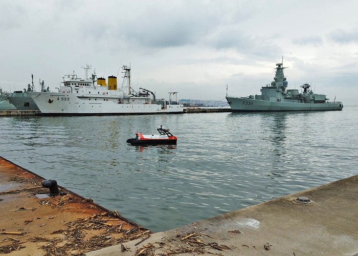
The Hydrographic Institute (IH) carried out, between 2 and 18 December, a hydrographic and geophysical survey in the area of the Lisbon Naval Base (BNL), including the Alfeite Channel and the Arsenal Channel, with the aim of acquiring up-to-date hydrographic and geological information essential for assessing and maintaining navigational safety conditions.
The study area of the BNL is characterised by significant sedimentary dynamics, marked by continuous silting processes, which makes this survey particularly relevant for monitoring the evolution of the seabed.
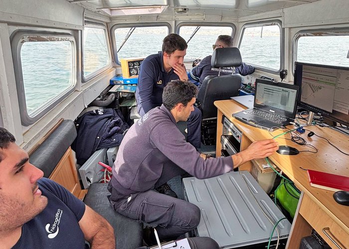
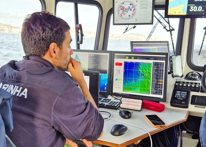
The survey included the acquisition of high-resolution bathymetry (multibeam) and the execution of seismic reflection profiles using the modern TOPAS PS120 system, which enabled the characterisation of sedimentary layer structures and the identification of consolidated bedrock at depth.
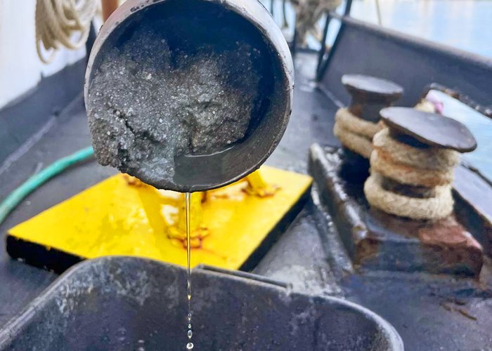
Several surface sediment samples were also collected using the Smith-McIntyre grab, as well as vertical samples obtained through the Vibrocorer system. These samples are currently being processed and represent a key technical and scientific contribution to supporting future actions at the Lisbon Naval Base.
The work was carried out aboard the hydrographic launches Orca and Gaivota, the Portuguese Navy Auxiliary Unit (UAM) Fisália, and with the deployment of the Unmanned Surface Vessel (USV) Atlas, whose operational use in confined waters took place for the first time.
Hydrographic Institute carriages out pioneering hydrographic and geophysical survey at the Lisbon Naval Base

Hydrographic Institute carriages out pioneering hydrographic and geophysical survey at the Lisbon Naval Base
Hydrographic Institute carriages out pioneering hydrographic and geophysical survey at the Lisbon Naval Base
Hydrographic Institute carriages out pioneering hydrographic and geophysical survey at the Lisbon Naval Base
Hydrographic Institute carriages out pioneering hydrographic and geophysical survey at the Lisbon Naval Base
Hydrographic Institute carriages out pioneering hydrographic and geophysical survey at the Lisbon Naval Base
108 