

Hydrographic Institute conducts surveys in strategic areas for the energy transition and economic development of Portugal
At the Instituto Hydrográfico (IH), of the Portuguese Navy, several programs are underway to characterize the marine environment and cartographic production, based on high resolution hydrographic surveys, which are carried out off the coast of mainland Portugal.
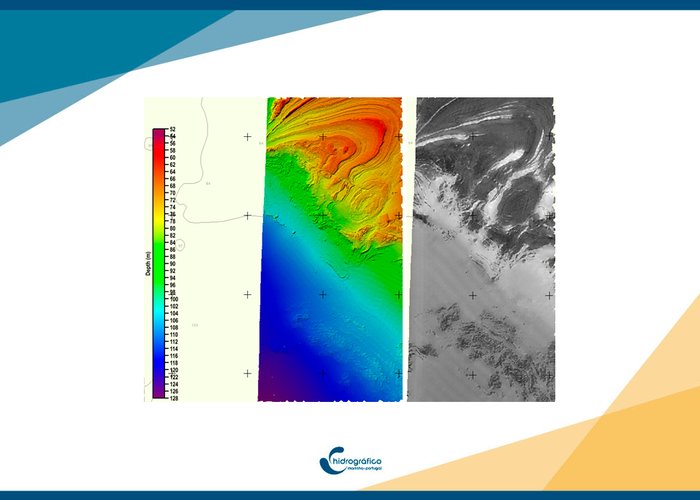
The images that are reproduced, recently obtained off the coast of mainland Portugal, in addition to the indicated use, still have a high value for any planning, design and installation of structures in the coastal area of the Portuguese margin, especially those that are expected to be used in the production of offshore wind energy.
The hydrographic surveys, carried out with a multi-beam probe, allow the obtaining of bathimetric models with much detail of the relief of the marine background (color image), as well as the respective acoustic mosaic (image in gray tones) that, after selective sedimentary sampling, will be converted into a remote classification map of the type of background and sedimentary deposits.
Following the identified needs for the proper physical description of the sedimentary layer, the IH intends to continue the characterisation of the marine bed structures with geophysical and geotechnical surveys, using seismic, lateral sonar, gradiometer and vertical samples (corers) of the sedimentary column.
Hydrographic Institute conducts surveys in strategic areas for the energy transition and economic development of Portugal
169 