

Hydrographic Institute provides data on marine bottom relief
Based on the mission of the SEAMAP 2030 (Portuguese Sea Mapping), the Hydrographic Institute (HI), in partnership with the Mission Structure for the Extension of the Continental Platform, began to provide data grids related to the relief of the marine bottom, in areas where the IH has batimetric data, in order to contribute to the conservation and sustainable use of the sea, supporting research and promoting development.
These deep-sea resolution grids are a significant contribution to ocean knowledge, supporting the SEABED 2030 project and, consequently, the objectives of the United Nations Ocean Science Decade for sustainable development.
The conservation and sustainable use of the oceans implies its understanding, and it is necessary to ensure a multidisciplinary knowledge, based on information on the morphology of the marine bottom.
Resolutions made available:
- Prof. 50m-250m – Res. 32m
- Prof. 250m-1000m – Res. 64m
- Prof. 1000m-2000m – Res. 128m
- Prof. 2000m-4000m – Res. 256m
- Prof. +4000m – Res. 512m
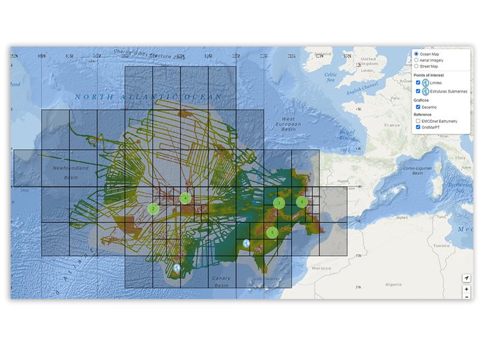
The data may be accessed through the following address: https://gridmar.Hidrografico.pt.
Hydrographic Institute provides data on marine bottom relief
134 
2022-05-12