

Hydrographic survey on Faial and Pico Islands
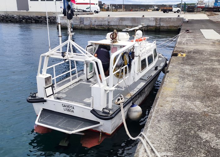
Surely you have heard the famous expression “we know more about the surface of Mars than the bottom of Earth’s oceans!”. This is because the rigorous and high-resolution mapping of the seabed is a very complex, demanding, costly process and that in most areas of the planet it is not possible to perform using the remote sensing capabilities of the thousands of satellites that are orbiting around our planet and that are constantly collecting and automatically processing data present on its surface. For being demanding, but not impossible is that the Hydrographic Brigade team of the Hydrographic Institute, works daily in the collection of acoustic data. Using the most advanced acoustic detection equipment and techniques worldwide, these soldiers face the demanding conditions of the seas on our Portuguese coast every day, thus contributing so that soon we can get to know our seabeds better than the surface of Mars.
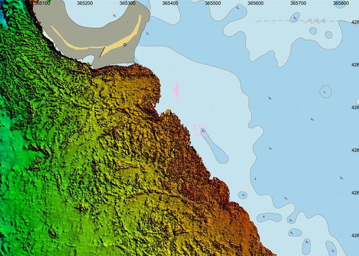
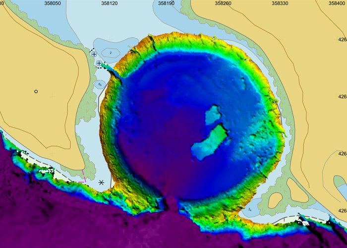
During July another crucial step was taken in this direction. In the framework of successful cooperation between the Hydrographic Institute and the General Directorate of Maritime Policies of the Regional Government of the Azores, a team of the Hydrographic Brigade consisting of 3 military members completed the coastal hydrographic survey of the Faial and Pico Islands. The hydrographic information collected will be useful for the maritime space planning process of the Azores, in the definition of policies related to the Protected Marine Areas, as well as to update the nautical mapping of the region.
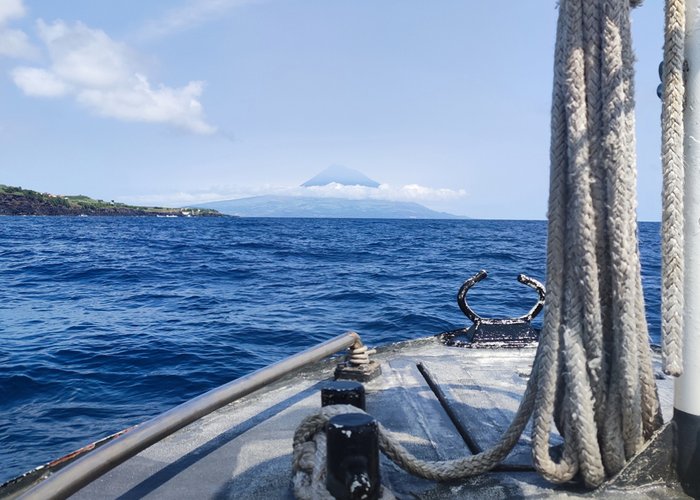
Here we share some images of the final phase of the work so that you can learn a little more about the “natural habitat” of our troops of the water brigade as well as the data they collect.
A holistic navy, ready, useful, focused, significant and technologically advanced once again to contribute to Portugal and the Portuguese remain at the forefront of scientific knowledge of the sea.
Hydrographic survey on Faial and Pico Islands
Hydrographic survey on Faial and Pico Islands
Hydrographic survey on Faial and Pico Islands
Hydrographic survey on Faial and Pico Islands
130 
2023-07-29