

Completion of the Water Survey in Cape Verde – Open Sea 20.2
The Hydrographic Brigade (BH) team embarked on the NRP Admiral Gago Coutinho (GC), framed in the Open Sea 20.2, completed the mission on February 13, 2021, counting 45 days of sea.
The missions of the Open Sea Initiative, developed since 2008, aim to contribute to the integrated effort to obtain maritime situational knowledge, scientific development and cooperative security of the international community in the central Atlantic Ocean region and to the satisfaction of the international commitments made by Portugal with the CPLP countries.
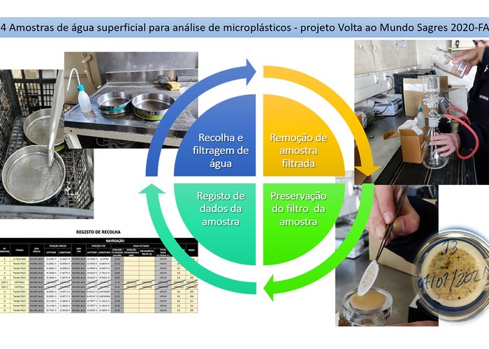
This mission, taking advantage of the GC's valencias reinforced with the shipment of 3 military personnel belonging to the BH, had a markedly scientific objective related to hydrographic surveys, collection of water samples for analysis of microplastics under the project Volta a Mundo Sagres 2020-FA and launch of drift buoys in the framework of cooperation with the Global Drifter Program - NOAA.
On the mission, BH performed:
- Installation of the Marégraph and reference station Real Time Kinematic (RTK) in Porto Grande for support to the port LH;
- Perenization and coordination of hydrographic support point in Porto Grande to perform the necessary positioning verification with the waterboat Mergluhão.
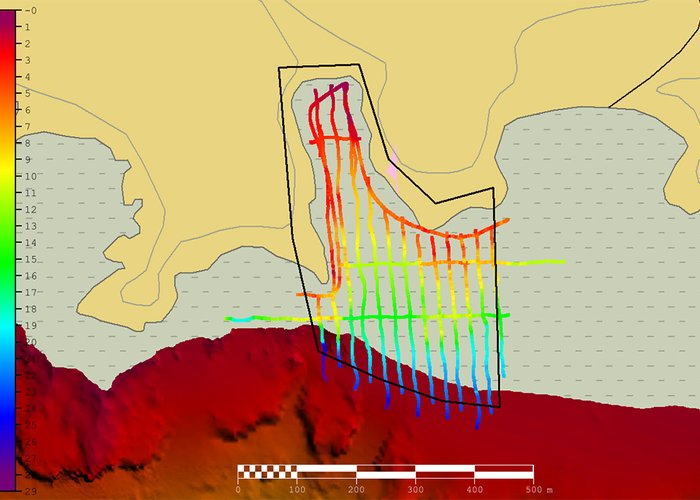
- What? a special hydrographic survey (LH), on the island of São Vicente in Porto Grande, in an area of 2 km2, with a high-resolution multi-beam system, with the Mergluhão waterboat;
- Installation of the Marégrafo in Porto da Praia to support the vertical reference to the LH performed by the GC and pneumatic boat on the island of Santiago.
- Two LH with simple beam system installed in a pneumatic boat in two bays on the island of Santiago. The landing and subsequent shipment of the boat was carried out by the GC near the polling areas;
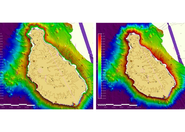
- What? Support for the on-board hydrography service, in the priority task of the mission that consisted of performing LH with GC around the island of Santiago the low depth within the UNTIeD Project - Unlocking the mega Tsunami Deadlock: using the near-source impacts to constrain tsunami generation by volcanic flank collapses. This island was fully probed to the isobath of 50 meters;
- What? Support for the hydrography service on board in the LH of opportunity south of the island of S. Vicente and underwater hills;
- On-board hydrographer training;
- What? Training to the hydrographer officer of Cape Verde: in this campaign, the Cape Verdean officer had the opportunity to acquire SMF data with three different systems and SPS. It also performed the processing of SPS and SMF data;
- 44 water harvests for microplastic analysis under the Sagres 2020-FA World Tour project.
In order to achieve the objectives, the CG had to make use of all the installed hydrographic valences: two low and medium-fund MPS and another large-fund system, reinforced with the human and material resources of the BH. The Mergulhão waterboat was used for port work and the pneumatic boat for practically extendable surveys to the sand. These facilities were operated by a team of four military personnel (three hydrographers and a boatmaster), supported by garrison members who collaborated in the hydrographic work.
In this mission, two bays were probed in the Island of Santiago to SPS with a spacing of 25 m, from half a meter deep to 50 m, using the pneumatic boat, in order to overlap the data acquired with SMF by the ship. Porto Grande was also surveyed in Mindelo, with high-resolution MPS, which allowed updating the hydrographic information of previous campaigns. This LH, due to the high resolution batimetric model (0.5m), allowed the discovery of two shipwrecks that were not mapped.
We also highlight the low-deep survey carried out by the CG around the island of Santiago where sea conditions were favorable, but with strong wind. The profitability of this type of LH is reduced to low depths. When the proximity to the land is reduced, the ship performs the probing wires always above part of the previously probed strip in order to anticipate the vertiginous rocky obstructions characteristic of the volcanic islands. It was an intense challenge, carried out safely, but with high demand.
At the end of the campaign, we took advantage of the ten-day transit from Cape Verde to Continental Portugal to begin processing the much data acquired in the mission, with the deep satisfaction of meeting the objectives proposed for the mission.
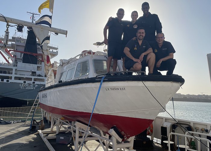
Note: in order to contextualize the aggregated photographs to this article it is reported that all personnel on board the CG were quarantined before starting mission and performed tests on the COVID-19 at the beginning and end of quarantine. By the fact that there were no positive cases, the use of mask was relieved.

Completion of the Water Survey in Cape Verde – Open Sea 20.2
Completion of the Water Survey in Cape Verde – Open Sea 20.2
Completion of the Water Survey in Cape Verde – Open Sea 20.2
Completion of the Water Survey in Cape Verde – Open Sea 20.2
Completion of the Water Survey in Cape Verde – Open Sea 20.2
127 
2021-02-13