

Top-hydrographic surveys in the Boavista and Sal Islands completed
The Hydrographic Brigade (BH) completed field work in the ports of Sal-King (Boavista Island) and Palmeira (Sal Island) in a campaign that lasted 5 days.
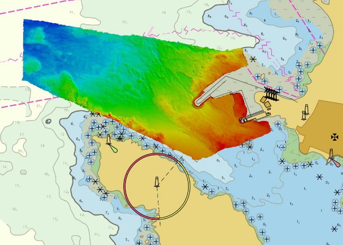
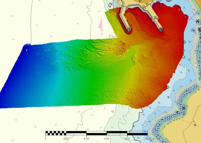
These works that fall within the Open Sea Initiative aimed at verifying the baptometric evolution of the fund, and also at collecting data for cartographic update.
In the Port of Sal-King, with a duration of 3 days, the following works were performed:
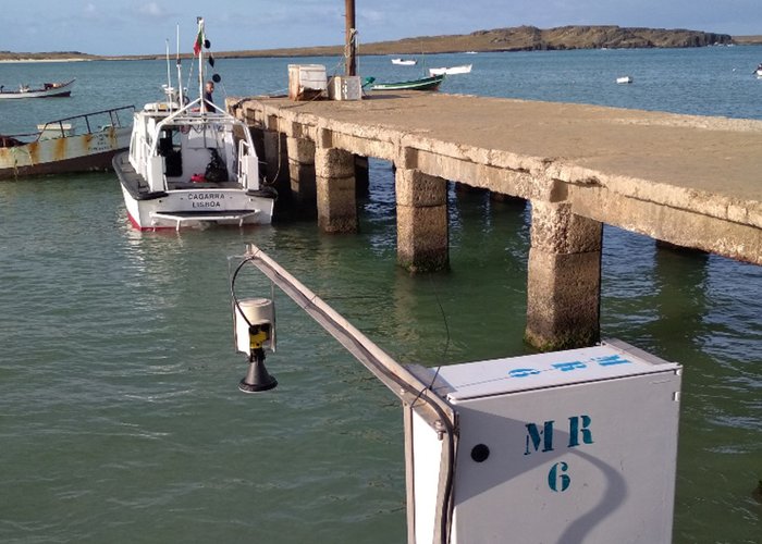
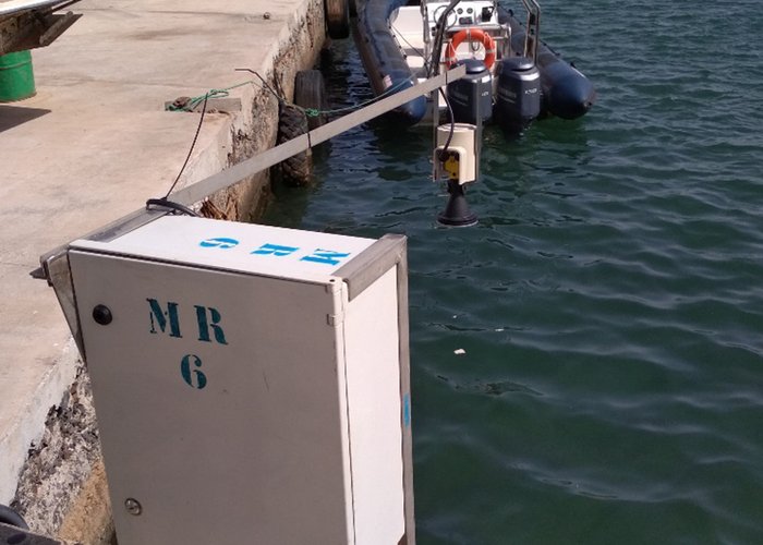
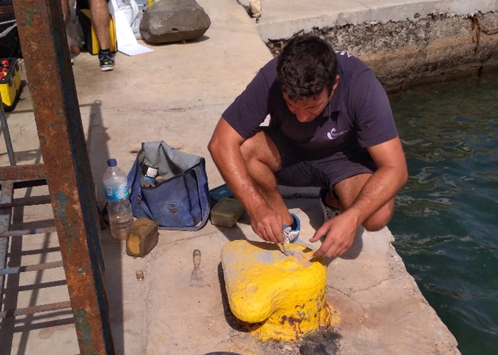
- Coordination of 4 floating and 1 fixed navigation aids;
- assembly of a tidal wave to support the hydrographic survey;
- Topographic survey of new port structures;
- Multi-beam system probe.
In Porto da Palmeira, with a duration of 2 days, the following works were performed:
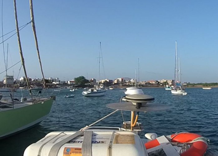
- coordination of 10 floating navigation aids;
- assembly of a tidal wave to support the hydrographic survey;
- Multi-beam system probe.
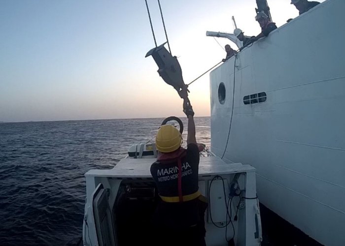
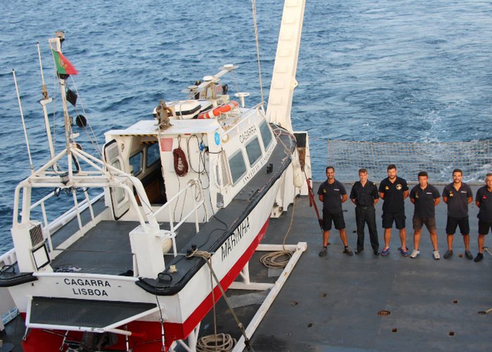
To carry out these works the team was designed with the Lancha “Cagarra” through the NRP D. Carlos I, with the 4 elements of the Hydrographic Brigade (BH) and with 2 reinforcements, the Head of Hydrography Service of the NRP D. Carlos I (Second Lieutenant STH Reis Videira) and a Spanish Navy Guest Officer specializing in Hydrography (Alferez de Navío Jesus Ortiz).
Top-hydrographic surveys in the Boavista and Sal Islands completed
Top-hydrographic surveys in the Boavista and Sal Islands completed
Top-hydrographic surveys in the Boavista and Sal Islands completed
Top-hydrographic surveys in the Boavista and Sal Islands completed
Top-hydrographic surveys in the Boavista and Sal Islands completed
Top-hydrographic surveys in the Boavista and Sal Islands completed
Top-hydrographic surveys in the Boavista and Sal Islands completed
Top-hydrographic surveys in the Boavista and Sal Islands completed
Top-hydrographic surveys in the Boavista and Sal Islands completed
136 