

18 May 2020: The Hydrographic Institute on International Museum Day
Under the sign of the sanitary contingency that is already announced near the end and with the hope of progressive deconfination, the International Museum Day celebrates, in its edition of 2020, with particular aggravity, the importance of digital communication between institutions and publics, amateurs, scholars and specialists in the area of museology and heritage.
As a military, scientific and cultural institution with important scientific, technical, cartographic and artistic collections, the Hydrographic Institute (IH) has developed an application of “Virtual Museum” which in 2020 will become publicly shared in time to join the 60-year celebrations of the Institute that are also celebrated in 2020.
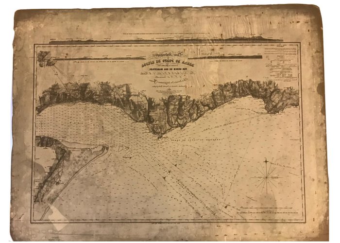
With partially visitable museological poles focusing on the sciences of the sea, hydrography, oceanography, navigation, geology and chemistry and pollution of the marine environment, the IH wanted to associate itself with the ephemeral of the International Museum Day, representing the emblematic «Plan Hydrographico da barra do porto de Lisboa», one of the most beautiful examples of the nineteenth-century Portuguese nautical cartography that is kept in the Historical Cartography Funds of the Institute.
The construction of this magnificent “Plan”, at scale 1:20000, began with the surveys and surveys carried out at the bar of the Tagus, between 1842 and 1845, following a royal Order passed by Queen D. Maria II, to the then lieutenants of the Armada, Caetano Maria Batalha (1810-1881) and Francisco Maria Pereira da Silva (1813-1891), one and the other, hydrographers engineers attached to the General Directorate of Geodetic Works, then directed by Councillor Filipe Folque. Lieutenant Carlos Botelho de Vasconcelos (1817-1896) joined this team.
With a neat graphic composition, centralized header and eclectic lettering, Victorian taste, finely engraved panoramas, this plan has benefited from the modern triangulation method presenting itself with an admirable time correction and sharpness.
Its publication, however, suffered the setbacks of the Civil War, political conflicts and economic hardship, only came about in the following decade in 1857. Recorded in strong water by the Polish master lithographer and painter Jan N. Lewicki (Osiek, 1798 – Paris, 1871), on the occasion of his stay in Portugal, between 1853 and 1860, «present to El-King» D. Pedro V, the map of the Port of Lisbon Barra was, for its «perfection and science» distinguished with the «approval and (...) Praise of His Majesty», publicly declared in Government Diary of 14 April 1858.
As to repair the delay in its first edition, it had the "Plano Hydrographico da barra do porto de Lisboa" of 1857, remarkable longevity and successive reissues, especially those of 1879 and 1893, that the IH also preserves copies, preserving the original matrix of the 1879 edition in a beautiful lithographic stone of numbered yellow limestone. A treat for amateurs in cartography.
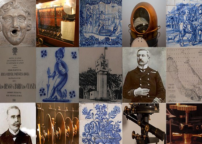
Image alluding to the application of “Virtual Museum” in development
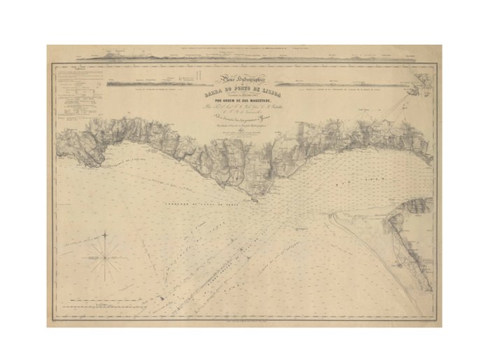
‘Plan Hydrographico da barra do porto de Lisboa, 1857’, 1879 edition
Litographic stone of the “Plano Hydrographico da barra do porto de Lisboa”, 1879 edition
106 
2020-05-18