

Unmanned vehicles
The Instituto Hidrográfico has several autonomous vehicles that aggregate various specific equipment for the survey of hydrographic, oceanographic and geological data
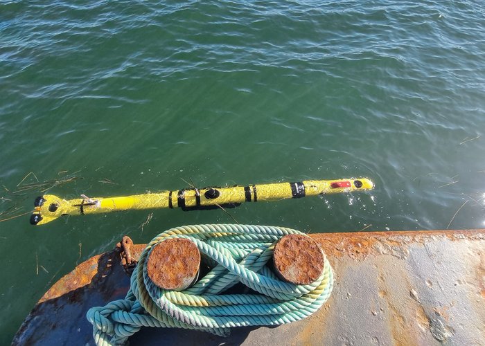
Glider
An autonomous underwater vehicle without its own propulsion system, designed for oceanographic research. Unlike traditional propeller-driven vehicles, gliders use a buoyancy control system, adjusting their density and the inclination of internal batteries to move vertically and glide through the water. Equipped with sensors, they collect data on parameters such as temperature, salinity (conductivity), and water quality during long-duration missions, which may last for weeks or even months. This capability makes them valuable tools for studying ocean conditions, currents, and marine ecosystems, offering an efficient and cost-effective means of data collection.
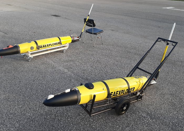
AUV (Autonomous Underwater Vehicle)
A torpedo-shaped autonomous underwater vehicle capable of carrying out a wide range of missions in the fields of Defence and Security, Oceanography, and Environmental Monitoring. It consists of two carbon-fibre cylinders connected by two terminal sections, housing the propulsion and steering thrusters, as well as an internal bladder that enables variation of the vehicle’s buoyancy. It is equipped with conductivity, temperature and pressure sensors, a camera, and a side-scan sonar, allowing for detailed observation of the underwater environment.
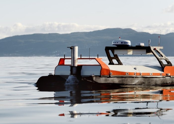
USV (Unmanned Surface Vehicle)
An autonomous surface vehicle of small or medium size (2 m and 4 m in length, respectively), designed for operations in sheltered or coastal waters and for rapid deployment. The ability to integrate a multibeam echo sounder and a winch fitted with a sound velocity profiler makes it capable of high-resolution seabed mapping, without the significant logistical footprint associated with manned vessels.
UAV (Unmanned Aerial Vehicle)
An autonomous aerial vehicle designed to support topographic surveys.
Currently, the Hydrographic Institute (IH) can equip it with sensors that allow photogrammetric flights, LiDAR surveys, and multispectral imaging, enabling the production of centimetre-resolution datasets. This platform has significantly increased the efficiency of IH operations: for instance, topographic surveys (such as beach profiles) that previously required multiple personnel and a range of equipment can now be performed by a single operator in a fraction of the time, ensuring greater safety, flexibility, and responsiveness in mapping and environmental monitoring activities.
ROV (Remotely Operated Vehicle)
An Remotely Operated Vehicle (ROV) is an unmanned, tethered underwater robot controlled by an operator on the surface. They are used for exploration, inspection, and tasks in deep or dangerous waters where humans cannot go, equipped with cameras, sensors, and robotic arms. The tether provides power and communication between the vehicle and the control station.
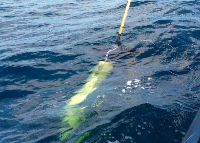
Glider
Gliders "Caldas" and "Leonor"
AUV
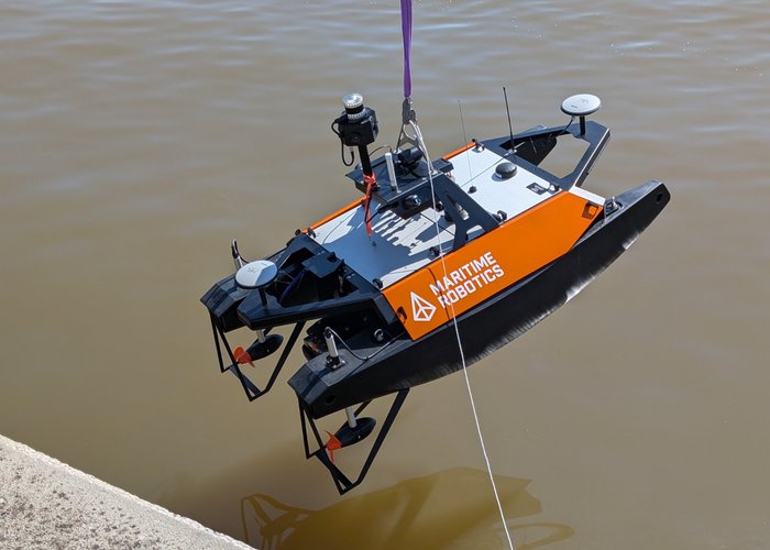
USV - Otter Pro "Pleione"
USV - Otter X "Atlas"
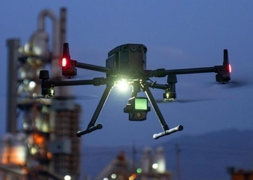
UAV - Matrix 300 RTK
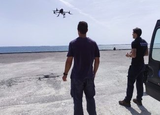
UAV - Matrix 300 RTK
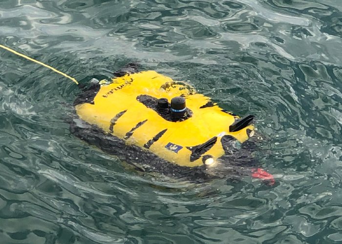
ROV Tortuga
895 
2024-05-28