

Equipment
The Instituto Hidrográfico has a number of specific equipment for surveying hydrographic, oceanographic and geological data. It also has equipment in its laboratories for sedimentological, geotechnical and geochemical analysis in soils and marine sediments; chemical analysis of natural waters sweet, marine, transition and coastal; and calibration of technical and scientific equipment and their sensors.
Field equipment
Topo-hydrographic
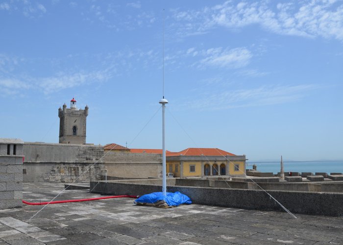
Hydrographic surveys use advanced technologies for accurate depth measurement and detailed mapping of the seabed and coastal areas. In the hydrographic component, single-beam and multibeam echo sounders are used. Single-beam echo sounder systems perform point-to-point measurements vertically from the platform and are particularly suitable for shallowaters. Multi-beam echo sounders emit multiple acoustic beams that cover a cross-section of the seabed, allowing for a survey with greater coverage. This technology allows for rapid and complete mapping of the seabed, ensuring the detection of structures that pose a danger to navigation, as well as relevant minimum depths. Sound velocity profilers are also used for making acoustic corrections in depth calculations. Topographic surveys use a combination of technologies, such as GNSS equipment, total stations and geometric levelling to map the terrain with high precision. Recently, unmanned aircraft systems equipped with multispectral sensors have been used to quickly collect elevation and image data from large and/or difficult-to-access areas, thus enabling the creation of a 3D representation of a given location.
Oceanographic
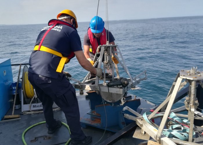
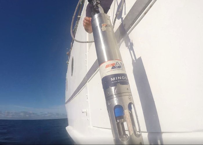
Oceanography uses a variety of field instruments to monitor the water column and ocean dynamics. Among these instruments, the CTD System stands out, used to measure conductivity, temperature and pressure throughout the water column. This system is usually operated with the support of Oceanographic Winches, which allow for its precise descent and retrieval. Ocean currents are monitored using instruments such as the Current Profiler, which measure the speed of particles suspended in the water. These equipment, as well as Multiparametric Buoys, are often integrated into moorings anchored to the seabed and are later recovered with the aid of Acoustic Release Devices. The IH also operates Wave Recorder Buoys to measure sea turbulence and maintains a network of Tide Gauge Stations and Coastal Radar Stations, which support operational oceanography and sea circulation modelling. In addition, the IH uses Drifting Buoys, instruments equipped with positioning and telemetry systems capable of measuring surface currents and transmitting data in real time, namely position, speed and sea surface temperature.
Marine Sedimentology
Marine Geology ensures the characterisation of the marine substrate through a wide range of specialised equipment for sediment sampling, which is essential for sedimentological and environmental studies. The Smith-McIntyre Sampler is used to collect unconsolidated surface sediments. In vertical samples of the sediment column, various types of samplers are used, including the Gravity Corer, Piston Corer, Box Corer, Multi-tube Corer and Vibrocorer. The choice of equipment depends on the characteristics of the subsoil and the specific objectives of the investigation. The operation of these systems is often supported by Specialised Winches and Acoustic Positioning Systems, which ensure accurate sample location. In addition, sedimentology uses Laser in situ transmissometry (LISST) sensors that employ the laser diffraction method to determine the concentration and size of suspended particles in the water column, contributing to the modelling of particle dynamics processes. Surface Pumps are used to sample suspended particulate matter, supplying Filtration Tables installed on board hydrographic vessels, where the samples are processed for subsequent sedimentological analysis.
Marine Geophysics
The mapping of the seabed and subsoil, crucial for navigation safety and environmental studies, is carried out using acoustic prospecting systems. The main seismic reflection systems operated at IH are Sub-Bottom Profiler and Boomer, which operate at frequencies that allow the structure of the marine subsoil to be determined. In addition, Side-Scan Sonars allow acoustic images of the seabed to be obtained. The IH also uses Magnetometers, which measure the intensity of the magnetic field and thus locate anomalies caused by the presence of objects composed of ferromagnetic materials. The operation of these systems is often supported by Specialised Winches and Acoustic Positioning Systems, which ensure the accurate location of equipment during data acquisition.
Marine Chemistry and Pollution
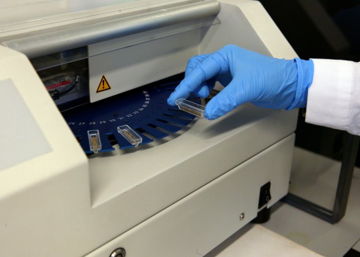
Research into marine chemistry and pollution is based on field samplers that are essential for oceanographic characterisation and environmental monitoring. For vertical analysis of the water column and continuous measurement of physical-chemical parameters, Multiparametric Sensors and the CTD-Rosette system are used, which allow real-time measurements of temperature, salinity, dissolved oxygen and turbidity. The CTD-Rosette system is equipped with Niskin bottles, which enable the collection of water samples at different depths, which are then analysed in the laboratory. Sampling of large volumes of surface water is carried out using Surface Pumps, supplying the Filtration Tables installed on board hydrographic vessels. These tables allow the samples to be prepared for detailed chemical analysis. For the collection of microplastics and plankton at the surface, Filtration/Trawl Nets suitable for small particles are used. Samples for monitoring pollutants/contaminants on the seabed are obtained using the Smith-McIntyre Sampler.
Laboratory Equipment
Laboratory of Chemistry and Pollution of the Marine Environment
- UV/VIS spectrometer;
- Infrared spectrometer;
- Atomic absorption spectrometer;
- Mercury analyzer;
- Segmented flow analyzer (SFA);
- Gas chromatograph with electronic capture detector (GC/ECD);
- Gas chromatograph with mass detector (GC/MS);
- Salinometer;
- Solvent Accelerated Extractor (ASE);
- Microwave digester;
- Lyophiliser;
- Inductive Plasma Mass Spectrometer (ICP-MS).
Sedimentology Laboratory:
Dimensional analysis (grain size – particle size):
- Sieves/Sieving;
- Sync (laser diffraction analysis);
- Camsizer P4 (dynamic image analysis).
Composite Analysis:
- Optical instrumentation (binocular magnifier and petrographic microscope);
- X-Ray Diffractometer (XRD);
- Infrared absorption spectrometer;
- X-Ray fluorescence spectrometer.
Geotechnical tests:
- Static Triaxial apparatus;
- Cone Penetrometer;
- Casagrande Shell;
- CRS cell;
- Automatic Laboratory Vane Tester.
Auxiliary equipment:
- Mills;
- Drying oven;
- High-precision balances.
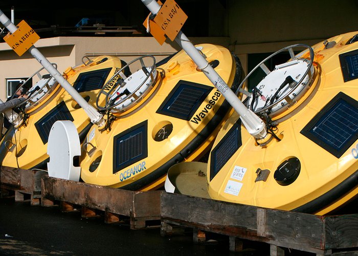
Multiparametric Buoys
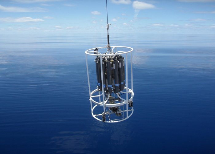
CTD/Rosette System
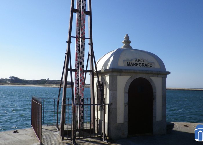
Tide Gauge
Current Profiler
Coastal Radar Station
Smith McIntyre Sampler
Mercury Analyser
Sound Velocity Profiler
995 
2018-03-08