

Cartography
Nautical Chart
Paper product, designed to meet the requirements of safety navigation. It may, in addition to the national folio, belong to the International Series – INT Nautical Chart, established and regulated by IHO (World Nautical Cartography Coverage).
Electronic Navigation Chart (ENC)
Digital vector product prepared according to the standards of the OHI for the safety of navigation, the only one that according to Chapter V of the SOLAS Convention replaces a CN provided that it operates in an ECDIS approved and certified in accordance with the standards of the International Electrotechnical Commission (IEC61174:2015).
ENCs are designed according to standard S-57 (S-57 – IHO Transfer Standard for Digital Hydrographic Data, ed.3.1. ), currently in transition to standard S-101 (ENC Product Specification). For more information on this standard see: Standard S-100.
ENCs are comercialized via International Centre for Electronic Navigational Charts (IC-ENC) (http://www.ic-enc. org/) and by authorized distributors.
Inland Waters Electronic Navigation Chart
The Inland Eletronic Navigation Chart (IENC), is a digital vector chart intended for use in an IECDIS (Inland ECDIS), produced in accordance with the requirements of IHO and Inland ENC Harmonization Group.
In the national cartographic folio, the IENCs belong to UB7. They are available for free download on the IH website, including the IENCs of the Douro Waterway and the Guadiana Waterway.
For more information
Consult Catálogo de Cartas e Publicações Náuticas and Hidrografico+.
Nautical charts can be purchased from Loja do Navegante of the Instituto Hidrográfico.
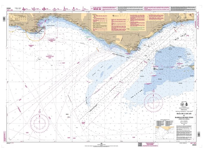
26303 (INT1875) "Baía de Cascais e Barras do Rio Tejo (Lisbon Harbour)"
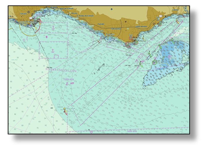
PT526303 "Baía de Cascais e Barras do Rio Tejo (Lisbon Harbour)"
40 
2024-05-27