GUAD20 - GUADIANA: NAVEGABLE NATURAL PATRIMONY
The project "GUAD20 - Guadiana: Navigable Natural Heritage" aimed to rehabilitate the navigability of the Guadiana river in the international section.
The project "GUAD20 - Guadiana: Navigable Natural Heritage" funded by the Operational Program for Transboundary Cooperation Portugal-Spain (POCTEP INTERREG V-A 2014-2020), aimed to rehabilitate the navigability of the Guadiana river in the international section between Vila Real de S.to António and Pomarão, in security conditions, as well as rehabilitating port infrastructures existing on both banks.
Under this project, the Hydrographic Institute was responsible for the production of the official hydrographic cartography of the Guadiana Navigable Way between Vila Real de S.to António and Pomarão, and carried out the following tasks:
- Top-hydrographic lifting;
- Technical support for redefining the navigation channel (Alcoutim a Pomaran);
- Design of river marking (Alcoutim a Pomaran);
- physicochemical sediment characterisation (Alcoutim to Pomarão);
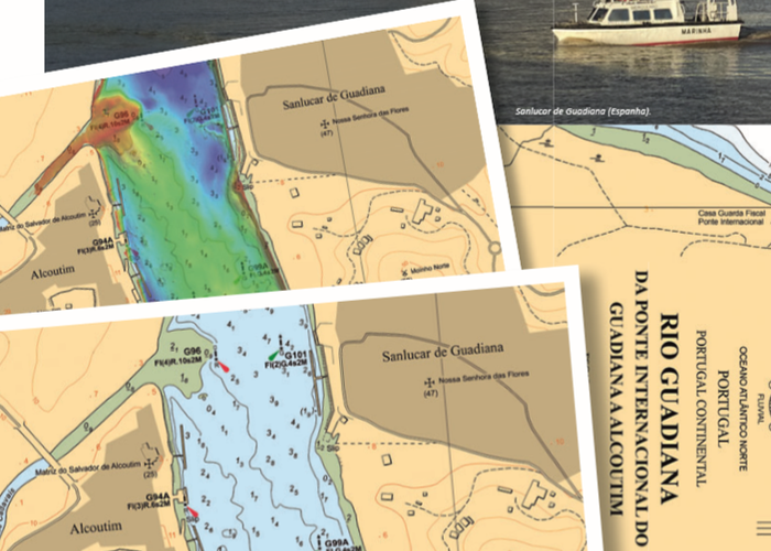
- Production of nautical cartography of the river series (paper and digital).
all completed work, including the publication of nautical cartography;
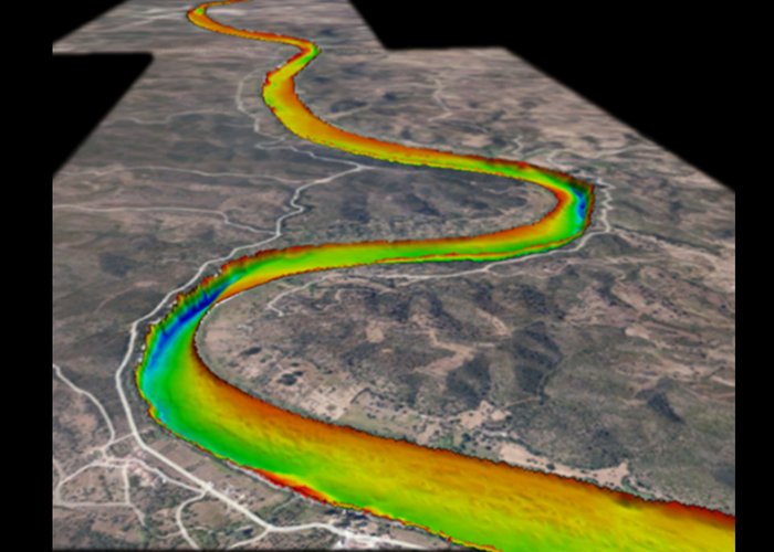
- The topographic and hydrographic surveys took place between 2017 and 2020 totaling about 108 days of fieldwork, 330 hours of survey in which the vessels covered approximately 1600 km in acquisition of batimetric data, constituting the basis of the other studies and works. Data volume occupies more than 1 TB of information on disk;
- The folio of the river series established for Guadiana consists of 2 cards, a total of 12 sheets in its paper format, and the corresponding number of cells in its electronic format;
- the implementation of the construction of river nautical cartography took place between 2018 and 2020;
- In June 2021, the nautical letters (CN) 26F21 (from the international bridge of Guadiana to Alcoutim) and CN 26F22 (from Alcoutim to Pomeranian) were published.
Via Navegável do Guadiana
Via Navegável do Guadiana
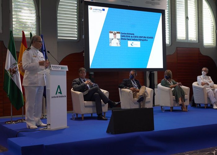
2021-07-07 Jornadas de encerramento, Huelva, Diretor-geral do Instituto Hidrográfico, Contra-almirante Carlos Ventura Soares
2017-05-16 | 2021-07-31
100 %
Partners

190 
2017-07-18